Approximate Location Map
Large Map »
Latitude: 51.6304 / 51°37'49"N
Longitude: -1.7108 / 1°42'38"W
OS Eastings: 420111
OS Northings: 192437
OS Grid: SU201924
Mapcode National: GBR 4TL.L9M
Mapcode Global: VHC0Q.98DZ
Plus Code: 9C3WJ7JQ+5M
Entry Name: 19B, High Street
Listing Date: 20 September 1979
Grade: II
Source: Historic England
Source ID: 1355956
English Heritage Legacy ID: 318400
ID on this website: 101355956
Location: Highworth, Swindon, Wiltshire, SN6
County: Swindon
Civil Parish: Highworth
Built-Up Area: Highworth
Traditional County: Wiltshire
Lieutenancy Area (Ceremonial County): Wiltshire
Church of England Parish: Highworth with Sevenhampton and Inglesham
Church of England Diocese: Bristol
Tagged with: Building
1.
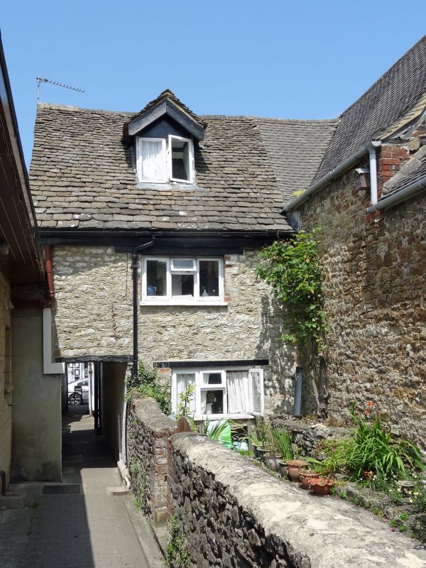
5410 HIGHWORTH HIGH STREET
(south side)
No 19B
SU 2092 SW 18/281
II GV
2.
No 19B extends south of No 19A (qv). C18 with first floor over a through
passage. Two and a half storeys. Rubble with stone slate roof. Gabled dormer
and one range of casements (modern), door to north.
Listing NGR: SU2011392438
External links are from the relevant listing authority and, where applicable, Wikidata. Wikidata IDs may be related buildings as well as this specific building. If you want to add or update a link, you will need to do so by editing the Wikidata entry.


Other nearby listed buildings
