Approximate Location Map
Large Map »
Latitude: 51.63 / 51°37'47"N
Longitude: -1.7117 / 1°42'42"W
OS Eastings: 420050
OS Northings: 192392
OS Grid: SU200923
Mapcode National: GBR 4TL.L36
Mapcode Global: VHC0Q.89Y9
Plus Code: 9C3WJ7HQ+X8
Entry Name: No 6 (Left Hand Block)
Listing Date: 20 September 1979
Grade: II
Source: Historic England
Source ID: 1299839
English Heritage Legacy ID: 318470
ID on this website: 101299839
Location: Highworth, Swindon, Wiltshire, SN6
County: Swindon
Civil Parish: Highworth
Built-Up Area: Highworth
Traditional County: Wiltshire
Lieutenancy Area (Ceremonial County): Wiltshire
Church of England Parish: Highworth with Sevenhampton and Inglesham
Church of England Diocese: Bristol
Tagged with: Building
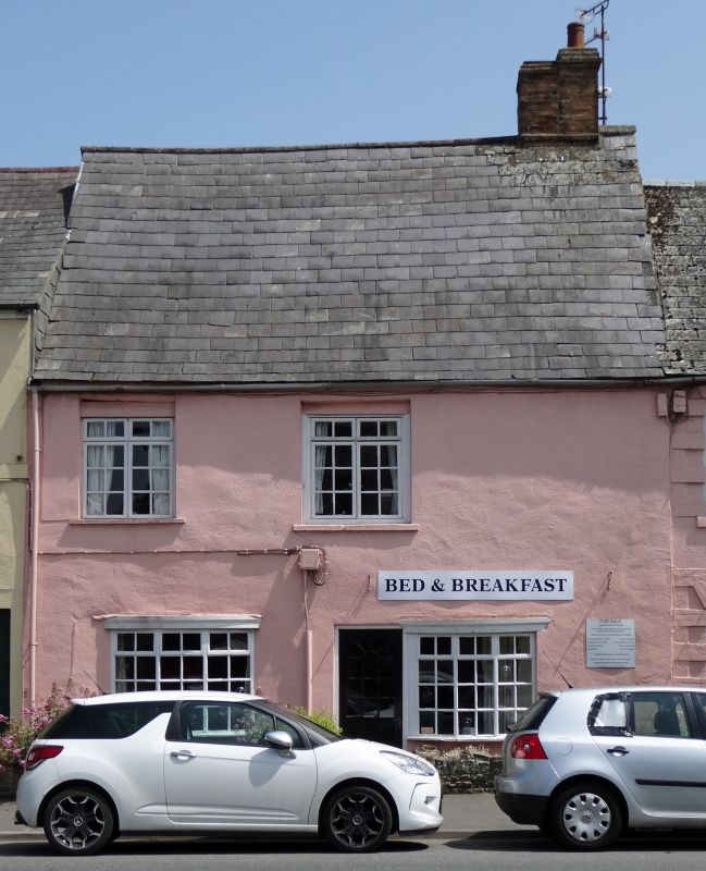
1.
5410 HIGHWORTH SWINDON STREET
(east side)
No 6 (left hand
block)
SU 2092 SW 18/339
II GV
2.
Late C17/early C18. Altered. Two storeys. Roughcast. Two ranges of modern
casement windows, including modern oriel bows on ground floor. Modem glazed
door in centre, also modern slate roof with steep pitch. Double brick chimney
to right.
Listing NGR: SU2005692389
External links are from the relevant listing authority and, where applicable, Wikidata. Wikidata IDs may be related buildings as well as this specific building. If you want to add or update a link, you will need to do so by editing the Wikidata entry.


Other nearby listed buildings
