Approximate Location Map
Large Map »
Latitude: 51.6669 / 51°40'0"N
Longitude: -1.7041 / 1°42'14"W
OS Eastings: 420560
OS Northings: 196495
OS Grid: SU205964
Mapcode National: GBR 4T6.FYY
Mapcode Global: VHC0J.DCZJ
Plus Code: 9C3WM78W+P9
Entry Name: Lynt Old Farmhouse
Listing Date: 20 September 1979
Grade: II
Source: Historic England
Source ID: 1023395
English Heritage Legacy ID: 318498
ID on this website: 101023395
Location: Upper Inglesham, Swindon, Wiltshire, SN6
County: Swindon
Civil Parish: Inglesham
Traditional County: Wiltshire
Lieutenancy Area (Ceremonial County): Wiltshire
Church of England Parish: Highworth with Sevenhampton and Inglesham
Church of England Diocese: Bristol
Tagged with: Farmhouse
1.
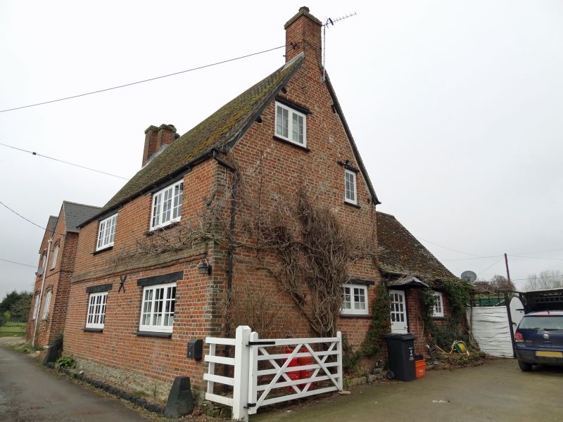
5410 INGLESHAM UPPER INGLESHAM
Lynt Old Farmhouse
SU 29 NW 3/380
II GV
2.
Early C18. Two and a half storeys, rendered, apparently over brick. Band
over ground floor, Modern tile roof with gable end brick chimneys. Gable
lit attic. Two ranges of altered 3 light casements. Catslide roof and entrance
to rear. Interior modernised.
Listing NGR: SU2056096495
External links are from the relevant listing authority and, where applicable, Wikidata. Wikidata IDs may be related buildings as well as this specific building. If you want to add or update a link, you will need to do so by editing the Wikidata entry.


Other nearby listed buildings
