Approximate Location Map
Large Map »
Latitude: 51.5891 / 51°35'20"N
Longitude: -1.7664 / 1°45'58"W
OS Eastings: 416281
OS Northings: 187828
OS Grid: SU162878
Mapcode National: GBR YTF.4G
Mapcode Global: VHB3F.BBK5
Plus Code: 9C3WH6QM+JC
Entry Name: Milestone Opposite St Philip's Road
Listing Date: 20 September 1979
Grade: II
Source: Historic England
Source ID: 1355943
English Heritage Legacy ID: 318550
ID on this website: 101355943
Location: Upper Stratton, Swindon, Wiltshire, SN2
County: Swindon
Civil Parish: Stratton St Margaret
Built-Up Area: Swindon
Traditional County: Wiltshire
Lieutenancy Area (Ceremonial County): Wiltshire
Church of England Parish: Upper Stratton St Philip
Church of England Diocese: Bristol
Tagged with: Milestone
1.
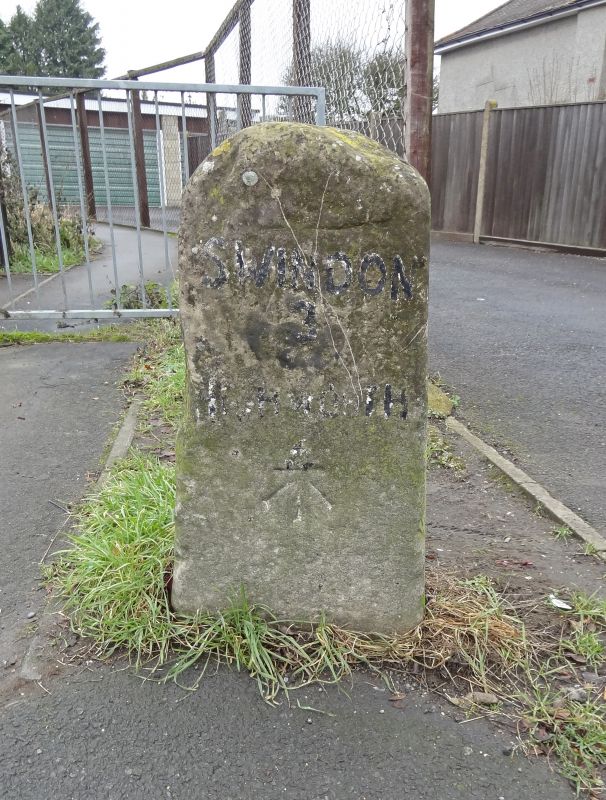
5410 STRATTON ST MARGARET BEECHCROFT ROAD
Kingsdown
Milestone opposite
SU 18 NE 8/452 St Philip's Road
II
2.
Late C18 or early C19. Typical local pattern with obscured inscription.
Now painted to read "Swindon 3 Highworth 4". Rounded face and top.
Listing NGR: SU1628187828
External links are from the relevant listing authority and, where applicable, Wikidata. Wikidata IDs may be related buildings as well as this specific building. If you want to add or update a link, you will need to do so by editing the Wikidata entry.


Other nearby listed buildings
