Approximate Location Map
Large Map »
Latitude: 51.5421 / 51°32'31"N
Longitude: -1.7003 / 1°42'1"W
OS Eastings: 420880
OS Northings: 182617
OS Grid: SU208826
Mapcode National: GBR 4VR.8XX
Mapcode Global: VHC13.GHZP
Plus Code: 9C3WG7RX+RV
Entry Name: 17, Church Road
Listing Date: 20 September 1979
Grade: II
Source: Historic England
Source ID: 1023419
English Heritage Legacy ID: 318567
ID on this website: 101023419
Location: Upper Wanborough, Swindon, Wiltshire, SN4
County: Swindon
Civil Parish: Wanborough
Built-Up Area: Wanborough
Traditional County: Wiltshire
Lieutenancy Area (Ceremonial County): Wiltshire
Church of England Parish: Lyddington and Wanborough
Church of England Diocese: Bristol
Tagged with: Building
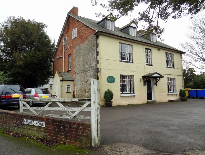
1.
5410 WANBOROUGH CHURCH ROAD
(south side)
Upper Wanborough
No 17
SU 2082 25/483
II
2.
Circa 1800, extended mid C19. Two and a half storeys, painted brick front.
Slate roof with gable end chimneys and 3 gabled dormers. Three windows, glazing
bar sashes, outer tripartite. Central half glazed door. Part rubble with
brick additions.
Listing NGR: SU2088682593
External links are from the relevant listing authority and, where applicable, Wikidata. Wikidata IDs may be related buildings as well as this specific building. If you want to add or update a link, you will need to do so by editing the Wikidata entry.


Other nearby listed buildings
