Approximate Location Map
Large Map »
Latitude: 51.5427 / 51°32'33"N
Longitude: -1.6996 / 1°41'58"W
OS Eastings: 420926
OS Northings: 182683
OS Grid: SU209826
Mapcode National: GBR 4VR.93H
Mapcode Global: VHC13.HHB7
Plus Code: 9C3WG8V2+34
Entry Name: 12, Church Road
Listing Date: 3 November 1978
Grade: II
Source: Historic England
Source ID: 1355909
English Heritage Legacy ID: 318569
ID on this website: 101355909
Location: Upper Wanborough, Swindon, Wiltshire, SN4
County: Swindon
Civil Parish: Wanborough
Built-Up Area: Wanborough
Traditional County: Wiltshire
Lieutenancy Area (Ceremonial County): Wiltshire
Church of England Parish: Lyddington and Wanborough
Church of England Diocese: Bristol
Tagged with: Building
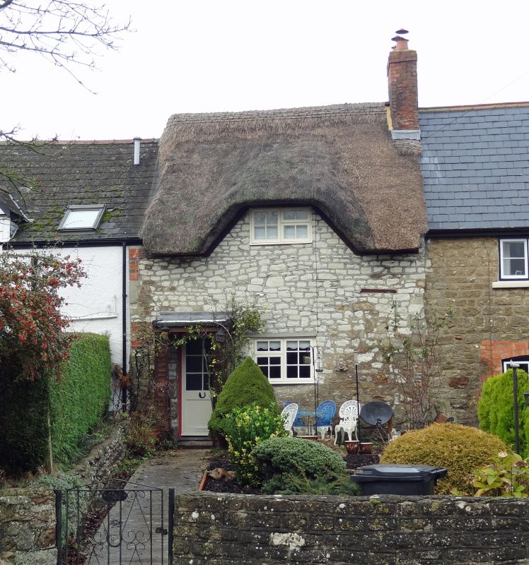
1.
5410 WANBOROUGH CHURCH ROAD
(north side)
Upper Wanborough
No 12
SU 2082 25/484 3.11.78
II GV
2.
C17 or C18. One and a half storey thatched rubble cottage. One small dormer
cut into thatch, 3 light casement on ground floor with wooden drip. Door
with modern porch to left. Brick chimney to right.
Listing NGR: SU2092682683
External links are from the relevant listing authority and, where applicable, Wikidata. Wikidata IDs may be related buildings as well as this specific building. If you want to add or update a link, you will need to do so by editing the Wikidata entry.


Other nearby listed buildings
