Approximate Location Map
Large Map »
Latitude: 51.5564 / 51°33'22"N
Longitude: -1.6949 / 1°41'41"W
OS Eastings: 421247
OS Northings: 184210
OS Grid: SU212842
Mapcode National: GBR 4VK.B9S
Mapcode Global: VHC13.K4TQ
Plus Code: 9C3WH844+H2
Entry Name: The Cottage
Listing Date: 20 September 1979
Grade: II
Source: Historic England
Source ID: 1023423
English Heritage Legacy ID: 318579
ID on this website: 101023423
Location: Horpit, Swindon, Wiltshire, SN4
County: Swindon
Civil Parish: Wanborough
Traditional County: Wiltshire
Lieutenancy Area (Ceremonial County): Wiltshire
Church of England Parish: Lyddington and Wanborough
Church of England Diocese: Bristol
Tagged with: Cottage Thatched cottage
1.
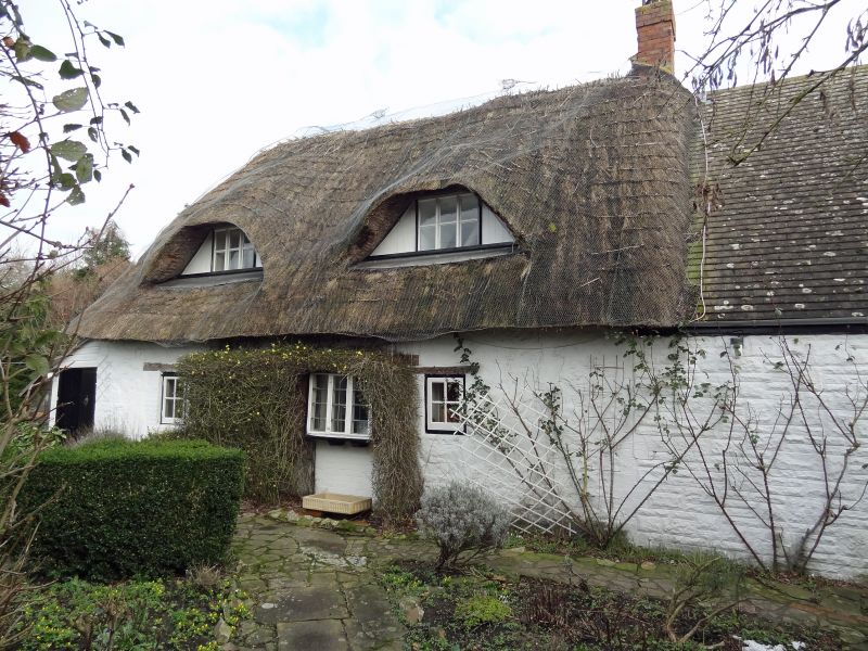
5410 WANBOROUGH HORPIT
The Cottage
SU 28 SW 12/507
II
2.
Probably C18 thatched cottage. Modernized and extended. Painted rubble.
Two eyebrow dormers. Three windows on ground floor, one formerly a door.
Modern extension with tiled roof to right.
Listing NGR: SU2124784210
External links are from the relevant listing authority and, where applicable, Wikidata. Wikidata IDs may be related buildings as well as this specific building. If you want to add or update a link, you will need to do so by editing the Wikidata entry.


Other nearby listed buildings
