Approximate Location Map
Large Map »
Latitude: 51.5209 / 51°31'15"N
Longitude: -1.803 / 1°48'10"W
OS Eastings: 413762
OS Northings: 180234
OS Grid: SU137802
Mapcode National: GBR 4VT.LYP
Mapcode Global: VHB3S.P1NF
Plus Code: 9C3WG5CW+8Q
Entry Name: Tomb of Thomas Washbourne
Listing Date: 20 September 1979
Grade: II
Source: Historic England
Source ID: 1299591
English Heritage Legacy ID: 318610
ID on this website: 101299591
Location: St John the Baptist and St Helen's Church, Elcombe, Swindon, Wiltshire, SN4
County: Swindon
Civil Parish: Wroughton
Built-Up Area: Wroughton
Traditional County: Wiltshire
Lieutenancy Area (Ceremonial County): Wiltshire
Church of England Parish: Wroughton
Church of England Diocese: Bristol
Tagged with: Tomb
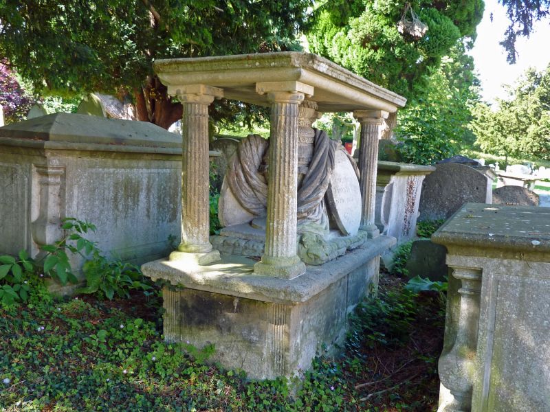
1.
5410 WROUGHTON CHURCH HILL
Tomb of Thomas Washbourne
SU 1380 22/529
II GV
2.
C1805 or 1836. Shaped chest tomb with plinth, 4 corner fluted Doric columns
to moulded canopy sheltering oval draped urn with memorial plaques. To Thomas
Washbourn (died 1805) and his wife Elizabeth (died 1836). Sited under vast
spread of churchyard Yew tree.
Listing NGR: SU1376280234
External links are from the relevant listing authority and, where applicable, Wikidata. Wikidata IDs may be related buildings as well as this specific building. If you want to add or update a link, you will need to do so by editing the Wikidata entry.


Other nearby listed buildings
