Approximate Location Map
Large Map »
Latitude: 51.0716 / 51°4'17"N
Longitude: -1.796 / 1°47'45"W
OS Eastings: 414385
OS Northings: 130276
OS Grid: SU143302
Mapcode National: GBR 517.NQV
Mapcode Global: FRA 7649.03S
Plus Code: 9C3W36C3+MH
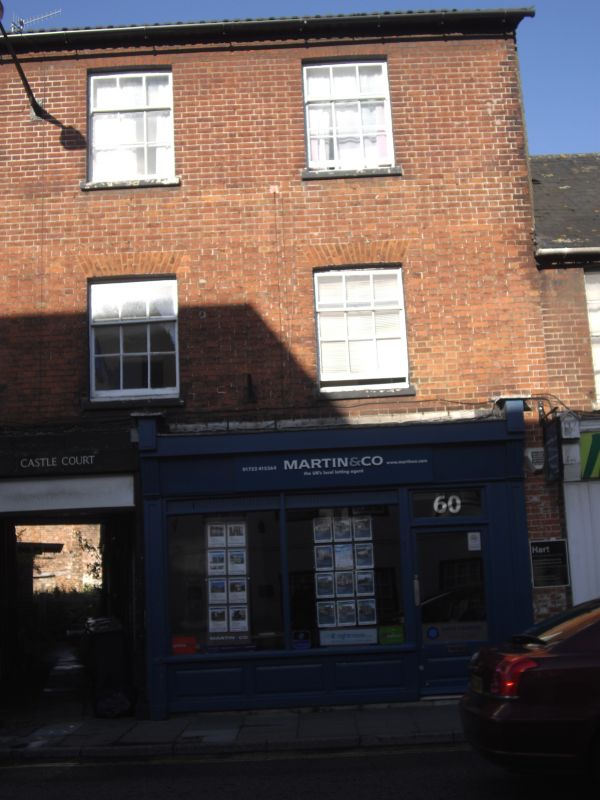
Entry Name: 60, Castle Street
Listing Date: 12 October 1972
Grade: II
Source: Historic England
Source ID: 1023567
English Heritage Legacy ID: 318926
ID on this website: 101023567
Location: Salisbury, Wiltshire, SP1
County: Wiltshire
Civil Parish: Salisbury
Built-Up Area: Salisbury
Traditional County: Wiltshire
Lieutenancy Area (Ceremonial County): Wiltshire
Church of England Parish: Salisbury St Thomas and St Edmund
Church of England Diocese: Salisbury
Tagged with: Building
CASTLE STREET
1.
1594
(East Side)
No 60
SU 1430 SW 1/613
II GV
2.
Early to mid C19. 3 storeys red brick. Low porch gable end slate roof, wide
eaves. 2 windows to upper floors, recessed sashes glazing bars intact. Ground
floor has later Victorian shop front and double doors to throughway.
Nos 52 to 64 (even) form a group.
Listing NGR: SU1438530276
External links are from the relevant listing authority and, where applicable, Wikidata. Wikidata IDs may be related buildings as well as this specific building. If you want to add or update a link, you will need to do so by editing the Wikidata entry.


Other nearby listed buildings
