Approximate Location Map
Large Map »
Latitude: 51.0661 / 51°3'57"N
Longitude: -1.7966 / 1°47'47"W
OS Eastings: 414348
OS Northings: 129657
OS Grid: SU143296
Mapcode National: GBR 51F.2M5
Mapcode Global: FRA 7639.KW2
Plus Code: 9C3W3683+C9
Entry Name: Gate Piers and Overthrow of Nos 21 and 21A
Listing Date: 12 October 1972
Grade: II
Source: Historic England
Source ID: 1023600
English Heritage Legacy ID: 318995
ID on this website: 101023600
Location: The Friary, Wiltshire, SP1
County: Wiltshire
Civil Parish: Salisbury
Built-Up Area: Salisbury
Traditional County: Wiltshire
Lieutenancy Area (Ceremonial County): Wiltshire
Tagged with: Gatepost
THE CLOSE
1.
1594
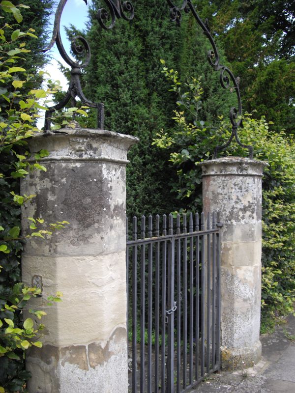
Gate piers and overthrow
of Nos 21 and 21A
SU 1429 NW 3/40C
II GV
2.
2 stone octagonal gate piers set opposite front entrance with very fine C18
wrought iron scrolled overthrow and lamp holder. Plain gates.
All the listed buildings in the Close form an oustanding group.
Listing NGR: SU1434829656
External links are from the relevant listing authority and, where applicable, Wikidata. Wikidata IDs may be related buildings as well as this specific building. If you want to add or update a link, you will need to do so by editing the Wikidata entry.


Other nearby listed buildings
