Approximate Location Map
Large Map »
Latitude: 51.0664 / 51°3'58"N
Longitude: -1.7968 / 1°47'48"W
OS Eastings: 414336
OS Northings: 129688
OS Grid: SU143296
Mapcode National: GBR 51F.2JW
Mapcode Global: FRA 7639.KTV
Plus Code: 9C3W3683+G7
Entry Name: Garden Wall Along Lane on West Side, of Nos 21 and 21A
Listing Date: 12 October 1972
Grade: II
Source: Historic England
Source ID: 1253070
English Heritage Legacy ID: 318996
ID on this website: 101253070
Location: The Friary, Wiltshire, SP1
County: Wiltshire
Civil Parish: Salisbury
Built-Up Area: Salisbury
Traditional County: Wiltshire
Lieutenancy Area (Ceremonial County): Wiltshire
Tagged with: Wall
THE CLOSE
1.
1594
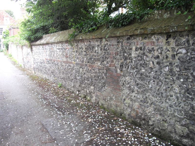
Garden Wall along lane
on west side, of Nos 21 & 2lA
SU 1429 NW 3/40D
II GV
2.
Flint rubble wall with brick bands and coping, some reused old stone.
All the listed buildings in the Close form an outstanding group.
Listing NGR: SU1435829704
External links are from the relevant listing authority and, where applicable, Wikidata. Wikidata IDs may be related buildings as well as this specific building. If you want to add or update a link, you will need to do so by editing the Wikidata entry.


Other nearby listed buildings
