Approximate Location Map
Large Map »
Latitude: 51.0661 / 51°3'57"N
Longitude: -1.7977 / 1°47'51"W
OS Eastings: 414270
OS Northings: 129660
OS Grid: SU142296
Mapcode National: GBR 51F.2BC
Mapcode Global: FRA 7639.KFX
Plus Code: 9C3W3682+CW
Entry Name: Rails Along Pavement of No 31
Listing Date: 12 October 1972
Grade: II
Source: Historic England
Source ID: 1261929
English Heritage Legacy ID: 319010
ID on this website: 101261929
Location: The Friary, Wiltshire, SP1
County: Wiltshire
Civil Parish: Salisbury
Built-Up Area: Salisbury
Traditional County: Wiltshire
Lieutenancy Area (Ceremonial County): Wiltshire
Tagged with: Architectural structure
THE CLOSE
1.
1594
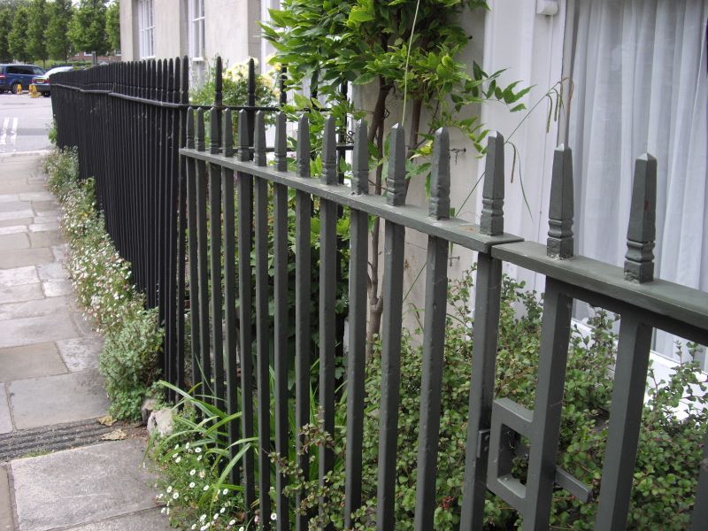
Rails along pavement
of No 31
SU 1429 NW 3/33A
II GV
2.
Plain spike iron rails along pavement either side of entrance.
All the listed buildings in the Close form an outstanding group.
Listing NGR: SU1426429660
External links are from the relevant listing authority and, where applicable, Wikidata. Wikidata IDs may be related buildings as well as this specific building. If you want to add or update a link, you will need to do so by editing the Wikidata entry.


Other nearby listed buildings
