Approximate Location Map
Large Map »
Latitude: 51.0663 / 51°3'58"N
Longitude: -1.7978 / 1°47'52"W
OS Eastings: 414263
OS Northings: 129678
OS Grid: SU142296
Mapcode National: GBR 51F.297
Mapcode Global: FRA 7639.KDR
Plus Code: 9C3W3682+GV
Entry Name: 37, the Close
Listing Date: 12 October 1972
Grade: II*
Source: Historic England
Source ID: 1355845
English Heritage Legacy ID: 319017
ID on this website: 101355845
Location: The Friary, Wiltshire, SP1
County: Wiltshire
Civil Parish: Salisbury
Built-Up Area: Salisbury
Traditional County: Wiltshire
Lieutenancy Area (Ceremonial County): Wiltshire
Tagged with: Building
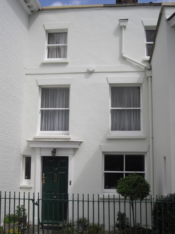
THE CLOSE
1.
1594
No 37
SU 1429 NW 3/28
II* GV
2.
C18 stucco front to C17 or earlier building. 2 storeys with plain parapet
and old tile roof. 2 windows with C19 sashes, no glazing bars. 6 panel door
to left with frame of pilasters frieze and cornice. Narrow 2 storey wing
projecting to pavement on right hand with C19 canted bay window on 1st floor,
sash lights, no glazing bars.
All the listed buildings in the Close form an outstanding group.
Listing NGR: SU1426329678
External links are from the relevant listing authority and, where applicable, Wikidata. Wikidata IDs may be related buildings as well as this specific building. If you want to add or update a link, you will need to do so by editing the Wikidata entry.


Other nearby listed buildings
