Approximate Location Map
Large Map »
Latitude: 51.0668 / 51°4'0"N
Longitude: -1.7988 / 1°47'55"W
OS Eastings: 414192
OS Northings: 129732
OS Grid: SU141297
Mapcode National: GBR 51F.21C
Mapcode Global: FRA 7639.K0G
Plus Code: 9C3W3682+PF
Entry Name: Forecourt Wall, Rails, Piers and Gate of No 55
Listing Date: 12 October 1972
Grade: II
Source: Historic England
Source ID: 1355810
English Heritage Legacy ID: 319034
ID on this website: 101355810
Location: Salisbury, Wiltshire, SP1
County: Wiltshire
Civil Parish: Salisbury
Built-Up Area: Salisbury
Traditional County: Wiltshire
Lieutenancy Area (Ceremonial County): Wiltshire
Tagged with: Wall
THE CLOSE
1.
1594
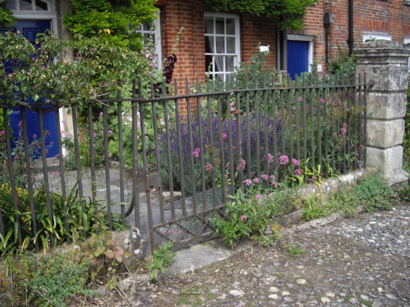
Forecourt wall, rails, piers
and gate of No 55
SU 1429 NW 3/17A
II GV
2.
Dwarf brick wall curving out from house with square stone rusticated corner
piers with moulded caps, plain wrought iron rails and gate in front of entrance.
All the listed buildings in the Close form an outstanding group.
Listing NGR: SU1419229732
External links are from the relevant listing authority and, where applicable, Wikidata. Wikidata IDs may be related buildings as well as this specific building. If you want to add or update a link, you will need to do so by editing the Wikidata entry.


Other nearby listed buildings
