Approximate Location Map
Large Map »
Latitude: 51.0665 / 51°3'59"N
Longitude: -1.799 / 1°47'56"W
OS Eastings: 414178
OS Northings: 129705
OS Grid: SU141297
Mapcode National: GBR 51F.1YZ
Mapcode Global: FRA 7639.JY2
Plus Code: 9C3W3682+J9
Entry Name: Boundary Wall to Pavement and Gates of No 56C
Listing Date: 12 October 1972
Grade: II
Source: Historic England
Source ID: 1023621
English Heritage Legacy ID: 319040
ID on this website: 101023621
Location: Salisbury, Wiltshire, SP1
County: Wiltshire
Civil Parish: Salisbury
Built-Up Area: Salisbury
Traditional County: Wiltshire
Lieutenancy Area (Ceremonial County): Wiltshire
Tagged with: Wall
THE CLOSE
1.
1594
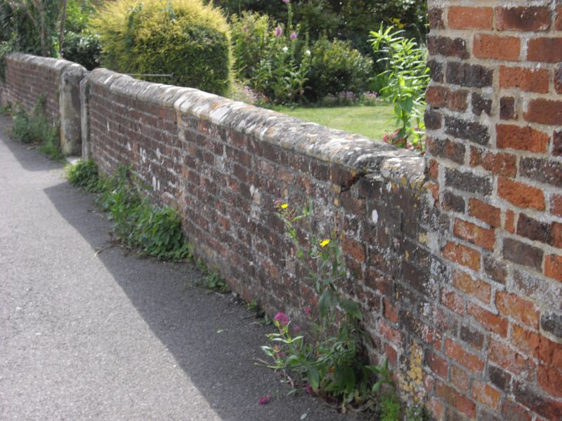
Boundary wall to pavement
and gates of No 56C
SU 1429 NW 3/15A
II GV
2.
Low brick boundary wall with stone coping. Plain iron gates.
All the listed buildings in the Close form an outstanding group.
Listing NGR: SU1417829705
External links are from the relevant listing authority and, where applicable, Wikidata. Wikidata IDs may be related buildings as well as this specific building. If you want to add or update a link, you will need to do so by editing the Wikidata entry.


Other nearby listed buildings
