Approximate Location Map
Large Map »
Latitude: 51.066 / 51°3'57"N
Longitude: -1.7994 / 1°47'57"W
OS Eastings: 414152
OS Northings: 129645
OS Grid: SU141296
Mapcode National: GBR 51F.1WZ
Mapcode Global: FRA 7639.JSY
Plus Code: 9C3W3682+96
Entry Name: Stable Block of No 59 (Arundalls)
Listing Date: 12 October 1972
Grade: II
Source: Historic England
Source ID: 1355812
English Heritage Legacy ID: 319046
ID on this website: 101355812
Location: The Friary, Wiltshire, SP1
County: Wiltshire
Civil Parish: Salisbury
Built-Up Area: Salisbury
Traditional County: Wiltshire
Lieutenancy Area (Ceremonial County): Wiltshire
Tagged with: Stable
THE CLOSE
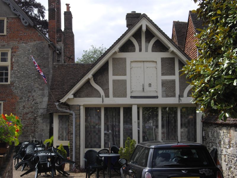
1.
1594
Stable block of
No 59 (Arundells)
SU 1429 NW 3/12A
II GV
2.
Small 1 storey and attic stone rubble and brick stables. Loft door is gable.
Old tile roof. Converted to garage.
All the listed buildings in the Close form an outstanding group.
Listing NGR: SU1415229645
External links are from the relevant listing authority and, where applicable, Wikidata. Wikidata IDs may be related buildings as well as this specific building. If you want to add or update a link, you will need to do so by editing the Wikidata entry.


Other nearby listed buildings
