Approximate Location Map
Large Map »
Latitude: 51.1942 / 51°11'38"N
Longitude: -1.9072 / 1°54'26"W
OS Eastings: 406577
OS Northings: 143886
OS Grid: SU065438
Mapcode National: GBR 3YD.4M0
Mapcode Global: VHB58.W7LW
Plus Code: 9C3W53VV+M4
Entry Name: Walls at Maddington Farm
Listing Date: 4 July 1985
Grade: II
Source: Historic England
Source ID: 1355686
English Heritage Legacy ID: 319867
ID on this website: 101355686
Location: Shrewton, Wiltshire, SP3
County: Wiltshire
Civil Parish: Shrewton
Built-Up Area: Shrewton
Traditional County: Wiltshire
Lieutenancy Area (Ceremonial County): Wiltshire
Church of England Parish: Salisbury Plain
Church of England Diocese: Salisbury
Tagged with: Wall
SHREWTON MADDINGTON STREET
SU 04 SE
(off south side)
3/326 Walls at Maddington
Farm
GV II
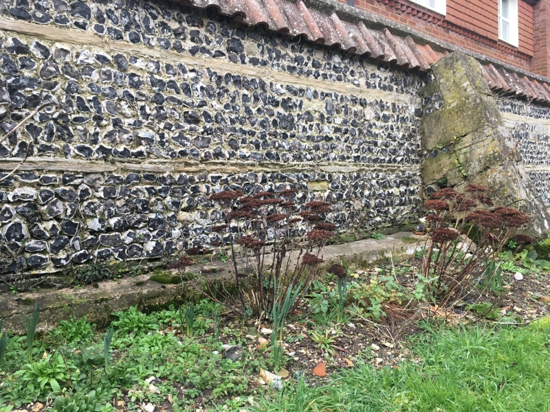
Walls enclosing C20 houses in Abbey Close on three sides. c1600.
Flint, limestone saddleback coping, partly replaced with pantiles
or Roman tiles. Probably the close walls of the Grange at
Maddington, formerly of the Benedictine nunnery at Amesbury.
Listing NGR: SU0657743886
External links are from the relevant listing authority and, where applicable, Wikidata. Wikidata IDs may be related buildings as well as this specific building. If you want to add or update a link, you will need to do so by editing the Wikidata entry.


Other nearby listed buildings
