Approximate Location Map
Large Map »
Latitude: 51.1786 / 51°10'43"N
Longitude: -1.6777 / 1°40'39"W
OS Eastings: 422623
OS Northings: 142204
OS Grid: SU226422
Mapcode National: GBR 61K.2MY
Mapcode Global: VHC2V.VMXT
Plus Code: 9C3W58HC+FW
Entry Name: Holly Tree Farmhouse
Listing Date: 29 May 1987
Grade: II
Source: Historic England
Source ID: 1023948
English Heritage Legacy ID: 319932
ID on this website: 101023948
Location: Cholderton, Wiltshire, SP4
County: Wiltshire
Civil Parish: Cholderton
Traditional County: Wiltshire
Lieutenancy Area (Ceremonial County): Wiltshire
Church of England Parish: Cholderton
Church of England Diocese: Salisbury
Tagged with: Farmhouse
CHOLDERTON GRATELEY ROAD
SU 24 SW
(north side)
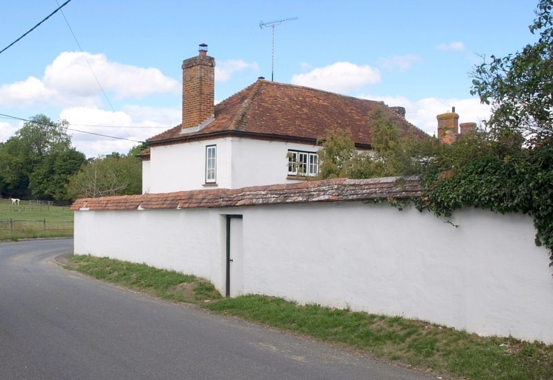
2/40 Holly Tree Farmhouse
II
Farmhouse. Mid-late C18. Rendered cob and brick with tiled
roof. Two storeys, 3 bays. Recessed central 6-panelled door,
partly glazed, and paned casement windows. Cogged eaves. Roof
hipped. Left bay extended to rear to join parallel rear block,
also hipped to right.
Listing NGR: SU2262342204
External links are from the relevant listing authority and, where applicable, Wikidata. Wikidata IDs may be related buildings as well as this specific building. If you want to add or update a link, you will need to do so by editing the Wikidata entry.


Other nearby listed buildings
