Approximate Location Map
Large Map »
Latitude: 51.0299 / 51°1'47"N
Longitude: -1.8979 / 1°53'52"W
OS Eastings: 407252
OS Northings: 125618
OS Grid: SU072256
Mapcode National: GBR 40C.6ZK
Mapcode Global: FRA 66XD.8F0
Plus Code: 9C3W24H2+XR
Entry Name: Wall to Road to West of Faulston House
Listing Date: 23 March 1960
Grade: II
Source: Historic England
Source ID: 1318742
English Heritage Legacy ID: 320641
ID on this website: 101318742
Location: Faulston, Wiltshire, SP5
County: Wiltshire
Civil Parish: Bishopstone
Traditional County: Wiltshire
Lieutenancy Area (Ceremonial County): Wiltshire
Church of England Parish: Bishopstone and Stratford Tony St John the Baptist
Church of England Diocese: Salisbury
Tagged with: Wall
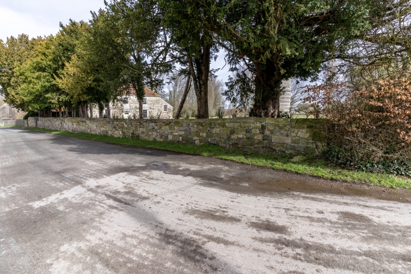
SU 02 NE BISHOPSTONE MILL LANE
(north side)
5/55 Wall to road to west of
Faulston House
23.3.60
GV II
Garden wall. Probably C18. Dressed limestone with some flint
chequers, stone pitched coping. Wall about 1.5 metres high runs
from west gate to Faulston House south to right angle bend in Mill
Lane.
Listing NGR: SU0725225618
External links are from the relevant listing authority and, where applicable, Wikidata. Wikidata IDs may be related buildings as well as this specific building. If you want to add or update a link, you will need to do so by editing the Wikidata entry.


Other nearby listed buildings
