Approximate Location Map
Large Map »
Latitude: 51.1695 / 51°10'10"N
Longitude: -1.7865 / 1°47'11"W
OS Eastings: 415025
OS Northings: 141166
OS Grid: SU150411
Mapcode National: GBR 502.R4J
Mapcode Global: VHB5B.ZVFT
Plus Code: 9C3W5697+RC
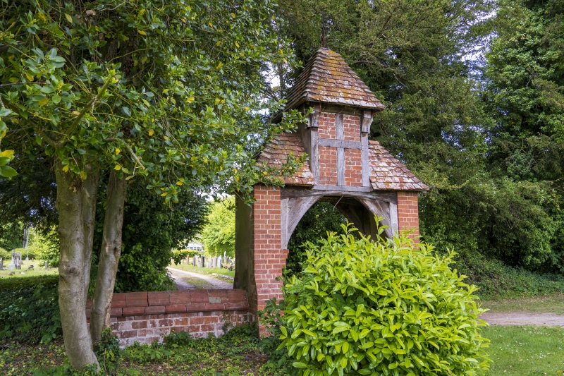
Entry Name: Cemetery Gate
Listing Date: 10 October 1988
Grade: II
Source: Historic England
Source ID: 1182631
English Heritage Legacy ID: 321370
ID on this website: 101182631
Location: Amesbury, Wiltshire, SP4
County: Wiltshire
Civil Parish: Amesbury
Traditional County: Wiltshire
Lieutenancy Area (Ceremonial County): Wiltshire
Church of England Parish: Amesbury St Mary and St Melor
Church of England Diocese: Salisbury
Tagged with: Gate
AMESBURY RECREATION ROAD
SU 1541
(south side)
11/59 Cemetery Gate
II
Gateway, after 1860, by William Butterfield. Brick with tiled
roof. Piers battered back twice carrying braces and timber framed
roof. Central section of roof raised with open framed
superstructure enclosing cross, and tiled pyramidal roof. Iron
decorative finial. Gates missing. The cemetery chapel, by
Butterfield and recorded in NMR, was demolished.
Listing NGR: SU1502541166
External links are from the relevant listing authority and, where applicable, Wikidata. Wikidata IDs may be related buildings as well as this specific building. If you want to add or update a link, you will need to do so by editing the Wikidata entry.


Other nearby listed buildings
