Approximate Location Map
Large Map »
Latitude: 54.4201 / 54°25'12"N
Longitude: -1.9221 / 1°55'19"W
OS Eastings: 405150
OS Northings: 502746
OS Grid: NZ051027
Mapcode National: GBR HK0B.N8
Mapcode Global: WHB55.F5X9
Plus Code: 9C6WC3CH+34
Entry Name: Methodist Chapel
Listing Date: 21 April 1986
Grade: II
Source: Historic England
Source ID: 1130818
English Heritage Legacy ID: 321995
ID on this website: 101130818
Location: Washfold, North Yorkshire, DL11
County: North Yorkshire
District: Richmondshire
Civil Parish: Marrick
Traditional County: Yorkshire
Lieutenancy Area (Ceremonial County): North Yorkshire
Tagged with: Chapel
MARRICK HURST
NZ 00 SE
11/57 Methodist Chapel
- II
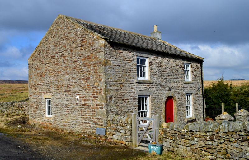
Wesleyan chapel. Early C19. Watershot rubble, with large flush quoins,
stone slate roof. 2 storeys. 2 first floor windows. Central doorway
with sandstone ashlar surround has semi-circular head and keystone,
paired boarded doors. Sashes with glazing bars. Ashlar copings, end
stack on right.
Listing NGR: NZ0515002746
External links are from the relevant listing authority and, where applicable, Wikidata. Wikidata IDs may be related buildings as well as this specific building. If you want to add or update a link, you will need to do so by editing the Wikidata entry.


Other nearby listed buildings
