Approximate Location Map
Large Map »
Latitude: 51.3993 / 51°23'57"N
Longitude: -2.3048 / 2°18'17"W
OS Eastings: 378891
OS Northings: 166741
OS Grid: ST788667
Mapcode National: GBR 0QD.63D
Mapcode Global: VH96N.03D3
Plus Code: 9C3V9MXW+P3
Entry Name: Boundary Wall and Gatepiers to No 23 (Eagle House)
Listing Date: 19 October 1983
Grade: II
Source: Historic England
Source ID: 1320513
English Heritage Legacy ID: 32205
ID on this website: 101320513
Location: Bathford, Bath and North East Somerset, Somerset, BA1
County: Bath and North East Somerset
Civil Parish: Bathford
Built-Up Area: Bath
Traditional County: Somerset
Lieutenancy Area (Ceremonial County): Somerset
Tagged with: Wall
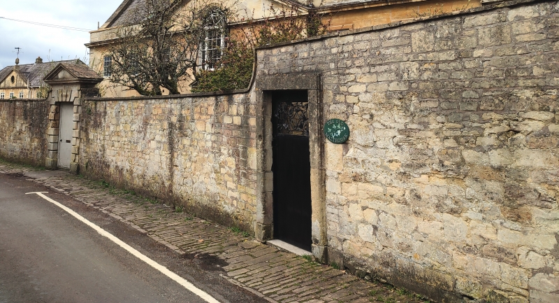
ST 7866-7966 BATHFORD C.D. CHURCH STREET
(North-west side)
9/36
Boundary wall to road
G.V. gatepiers and gate to No.
23 (Eagle House)
II
Boundary wall and gateway. Mid C18th. Random rubble, coped. Rusticated
doorcase with pediment, later 6-panel door. Further door to right in plain
stone surround. Forms part of an important linear townscape feature.
Listing NGR: ST7889166741
External links are from the relevant listing authority and, where applicable, Wikidata. Wikidata IDs may be related buildings as well as this specific building. If you want to add or update a link, you will need to do so by editing the Wikidata entry.


Other nearby listed buildings
