Approximate Location Map
Large Map »
Latitude: 54.4057 / 54°24'20"N
Longitude: -2.2103 / 2°12'37"W
OS Eastings: 386443
OS Northings: 501162
OS Grid: NY864011
Mapcode National: GBR FK0H.8F
Mapcode Global: WHB51.0JQB
Plus Code: 9C6VCQ4Q+7V
Entry Name: Bridge Approximately 200 Metres East of Firs Farmhouse
Listing Date: 5 September 1986
Grade: II
Source: Historic England
Source ID: 1131524
English Heritage Legacy ID: 322218
ID on this website: 101131524
Location: North Yorkshire, DL11
County: North Yorkshire
District: Richmondshire
Civil Parish: Muker
Traditional County: Yorkshire
Lieutenancy Area (Ceremonial County): North Yorkshire
Tagged with: Bridge Driveway bridge
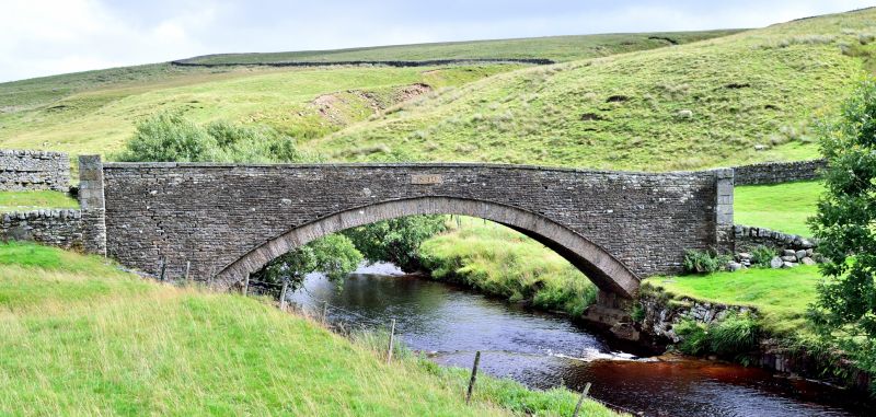
NY 80 SE MUKER BIRKDALE
7/133 Bridge approximately 200
metres east of Firs
Farmhouse
- II
Bridge. Dated 1840. Coursed rubble. Segmental arch of rubble voussoirs
surmounted by thin slab hoodmould. Crude piers terminate parapets which
have slab copings. Dated on upstream side.
Listing NGR: NY8644301162
External links are from the relevant listing authority and, where applicable, Wikidata. Wikidata IDs may be related buildings as well as this specific building. If you want to add or update a link, you will need to do so by editing the Wikidata entry.


Other nearby listed buildings
