Approximate Location Map
Large Map »
Latitude: 54.4017 / 54°24'6"N
Longitude: -1.7396 / 1°44'22"W
OS Eastings: 417002
OS Northings: 500725
OS Grid: NZ170007
Mapcode National: GBR JK9J.5W
Mapcode Global: WHC6D.7MWF
Plus Code: 9C6WC726+M5
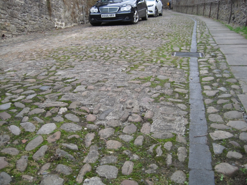
Entry Name: Cobble stones on roadway
Listing Date: 15 October 1973
Grade: II
Source: Historic England
Source ID: 1211843
English Heritage Legacy ID: 322924
ID on this website: 101211843
Location: Richmond, North Yorkshire, DL10
County: North Yorkshire
District: Richmondshire
Civil Parish: Richmond
Built-Up Area: Richmond
Traditional County: Yorkshire
Lieutenancy Area (Ceremonial County): North Yorkshire
Church of England Parish: Richmond with Holy Trinity with Hudswell
Church of England Diocese: Leeds
Tagged with: Architectural structure
This list entry was subject to a Minor Amendment on 26 May 2021 to reformat the text to current standards
NZ 1700 NW
1/342
CORNFORTH HILL
Cobble stones on roadway
GV
II
Cobble roadway.
The Cobbled Roadway forms a group with the listed buildings in Cornforth Hill
Listing NGR: NZ1700200725
External links are from the relevant listing authority and, where applicable, Wikidata. Wikidata IDs may be related buildings as well as this specific building. If you want to add or update a link, you will need to do so by editing the Wikidata entry.


Other nearby listed buildings
