Approximate Location Map
Large Map »
Latitude: 53.9638 / 53°57'49"N
Longitude: -2.0183 / 2°1'5"W
OS Eastings: 398899
OS Northings: 451973
OS Grid: SD988519
Mapcode National: GBR GQBL.VT
Mapcode Global: WHB77.ZM3M
Plus Code: 9C5VXX7J+GM
Entry Name: Pound, or Pinfold
Listing Date: 2 March 1978
Grade: II
Source: Historic England
Source ID: 1131856
English Heritage Legacy ID: 323504
ID on this website: 101131856
Location: Mill Fields, North Yorkshire, BD23
County: North Yorkshire
District: Craven
Civil Parish: Skipton
Built-Up Area: Skipton
Traditional County: Yorkshire
Lieutenancy Area (Ceremonial County): North Yorkshire
Tagged with: Animal pound
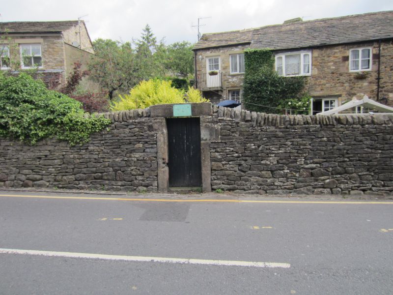
1.
5336 RAIKES ROAD
Pound, or pinfold
SD 9851 1/126
II GV
2.
Uncertain date. Stone rubble wall about 5 ft high enclosing an irregular pound,
with rectangular doorway and boarded door.
Listing NGR: SD9889951973
External links are from the relevant listing authority and, where applicable, Wikidata. Wikidata IDs may be related buildings as well as this specific building. If you want to add or update a link, you will need to do so by editing the Wikidata entry.


Other nearby listed buildings
