Approximate Location Map
Large Map »
Latitude: 53.8838 / 53°53'1"N
Longitude: -2.0133 / 2°0'47"W
OS Eastings: 399223
OS Northings: 443064
OS Grid: SD992430
Mapcode National: GBR GRCJ.XJ
Mapcode Global: WHB7N.1MKZ
Plus Code: 9C5VVXMP+GM
Entry Name: Lund's Tower
Listing Date: 23 October 1984
Grade: II
Source: Historic England
Source ID: 1131781
English Heritage Legacy ID: 323636
Also known as: Sutton Pinnacle
Ethel Tower
Jubilee Tower
ID on this website: 101131781
Location: North Yorkshire, BD20
County: North Yorkshire
District: Craven
Civil Parish: Sutton
Built-Up Area: Cross Hills
Traditional County: Yorkshire
Lieutenancy Area (Ceremonial County): North Yorkshire
Church of England Parish: Sutton-in-Craven St Thomas
Church of England Diocese: Leeds
Tagged with: Folly tower
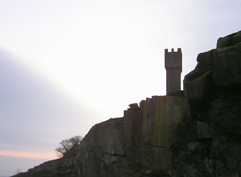
SD 94 SE SUTTON OLD OAKWORTH ROAD
5/109
Lund's Tower
GV
II
Landmark, 1887. Squared dressed stone. A small square tower with plinth and
corbelled battlements. A plaque is now illegible. Stone spiral stair inside.
Listing NGR: SD9922343064
External links are from the relevant listing authority and, where applicable, Wikidata. Wikidata IDs may be related buildings as well as this specific building. If you want to add or update a link, you will need to do so by editing the Wikidata entry.


Other nearby listed buildings
