Approximate Location Map
Large Map »
Latitude: 53.8824 / 53°52'56"N
Longitude: -2.0249 / 2°1'29"W
OS Eastings: 398462
OS Northings: 442910
OS Grid: SD984429
Mapcode National: GBR GR9K.F0
Mapcode Global: WHB7M.VPY1
Plus Code: 9C5VVXJG+X3
Entry Name: Wainman's Pinnacle
Listing Date: 23 October 1984
Grade: II
Source: Historic England
Source ID: 1166685
English Heritage Legacy ID: 323637
ID on this website: 101166685
Location: Lane Ends, North Yorkshire, BD20
County: North Yorkshire
District: Craven
Civil Parish: Sutton
Traditional County: Yorkshire
Lieutenancy Area (Ceremonial County): North Yorkshire
Church of England Parish: Sutton-in-Craven St Thomas
Church of England Diocese: Leeds
Tagged with: Folly tower
SD 94 SE SUTTON OLD OAKWORTH ROAD
5/110
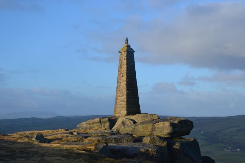
Wainman's Pinnacle
GV
II
Landmark, 1898. Tapering pier of triangular section, of rock-faced stone with coping
and spike finial. Said to have been first erected as a memorial to the Napoleonic
Wars, by a member of the Wainman family of Head Hall, Cowling CP (qv). (A Wood,
editor, Cowling: A Moorland Parish, 1980).
Listing NGR: SD9846242910
External links are from the relevant listing authority and, where applicable, Wikidata. Wikidata IDs may be related buildings as well as this specific building. If you want to add or update a link, you will need to do so by editing the Wikidata entry.


Other nearby listed buildings
