Approximate Location Map
Large Map »
Latitude: 54.1495 / 54°8'58"N
Longitude: -2.2958 / 2°17'44"W
OS Eastings: 380778
OS Northings: 472666
OS Grid: SD807726
Mapcode National: GBR DNDG.R9
Mapcode Global: WH950.PYZV
Plus Code: 9C6V4PX3+QM
Entry Name: Gray Bridge
Listing Date: 23 November 1988
Grade: II
Source: Historic England
Source ID: 1212589
English Heritage Legacy ID: 324549
ID on this website: 101212589
Location: Horton in Ribblesdale, North Yorkshire, BD24
County: North Yorkshire
District: Craven
Civil Parish: Horton in Ribblesdale
Traditional County: Yorkshire
Lieutenancy Area (Ceremonial County): North Yorkshire
Church of England Parish: Horton-in-Ribblesdale St Oswald
Church of England Diocese: Leeds
Tagged with: Bridge
HORTON IN RIBBLESDALE MAIN STREET
SD 8072-8172
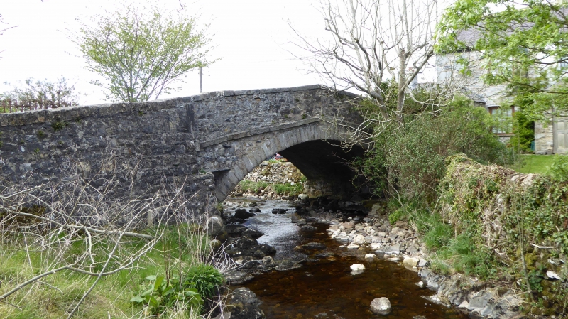
15/13 Gray Bridge
-
GV II
Road bridge. Probably mid-late C18. Rubble and dressed stone. Single-span
segmental arch, raked parapet with raked string course at base.
Listing NGR: SD8077872666
External links are from the relevant listing authority and, where applicable, Wikidata. Wikidata IDs may be related buildings as well as this specific building. If you want to add or update a link, you will need to do so by editing the Wikidata entry.


Other nearby listed buildings
