Approximate Location Map
Large Map »
Latitude: 53.7847 / 53°47'5"N
Longitude: -1.0689 / 1°4'8"W
OS Eastings: 461442
OS Northings: 432449
OS Grid: SE614324
Mapcode National: GBR NSZP.C0
Mapcode Global: WHFD2.K46C
Plus Code: 9C5WQWMJ+VC
Entry Name: 25, Finkle Street
Listing Date: 14 November 1980
Grade: II
Source: Historic England
Source ID: 1132564
English Heritage Legacy ID: 325731
ID on this website: 101132564
Location: Selby, North Yorkshire, YO8
County: North Yorkshire
District: Selby
Civil Parish: Selby
Built-Up Area: Selby
Traditional County: Yorkshire
Lieutenancy Area (Ceremonial County): North Yorkshire
Church of England Parish: Selby St Mary and St Germain
Church of England Diocese: York
Tagged with: Building
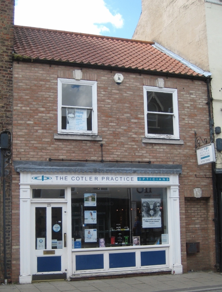
FINKLE STREET
1. (west side)
5342 -------------
No 25
SE 6132 SW 4/51A
II GV
2.
C18. Stucco. Pitched pantile roof. Two storeys. Two flush-framed sashes
with triple keystones on first floor. Passageway with triple keystone on
ground floor. modern shop-front.
Listing NGR: SE6144232448
External links are from the relevant listing authority and, where applicable, Wikidata. Wikidata IDs may be related buildings as well as this specific building. If you want to add or update a link, you will need to do so by editing the Wikidata entry.


Other nearby listed buildings
