Approximate Location Map
Large Map »
Latitude: 53.7851 / 53°47'6"N
Longitude: -1.0684 / 1°4'6"W
OS Eastings: 461476
OS Northings: 432490
OS Grid: SE614324
Mapcode National: GBR NSZN.HW
Mapcode Global: WHFD2.K4F3
Plus Code: 9C5WQWPJ+2J
Entry Name: 39, Micklegate
Listing Date: 14 November 1980
Grade: II
Source: Historic England
Source ID: 1296963
English Heritage Legacy ID: 325786
ID on this website: 101296963
Location: Selby, North Yorkshire, YO8
County: North Yorkshire
District: Selby
Civil Parish: Selby
Built-Up Area: Selby
Traditional County: Yorkshire
Lieutenancy Area (Ceremonial County): North Yorkshire
Church of England Parish: Selby St Mary and St Germain
Church of England Diocese: York
Tagged with: Building
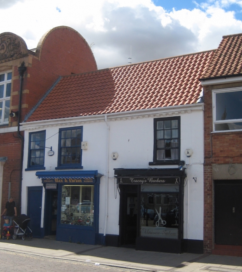
MICKLEGATE
1. (north-west side)
5342 -----------------
No 39
SE 6132 SW 4/95
II
2.
C18. Stuccoed (probably in C19). Pitched modern pantile roof. Two storeys.
Modillion eaves cornice. Three flush-framed sashes with glazing bars on first
floor. Two C19 shop-fronts with contemporary awnings in situ. Passage entrance
to left-hand.
Listing NGR: SE6147632490
External links are from the relevant listing authority and, where applicable, Wikidata. Wikidata IDs may be related buildings as well as this specific building. If you want to add or update a link, you will need to do so by editing the Wikidata entry.


Other nearby listed buildings
