Approximate Location Map
Large Map »
Latitude: 53.7871 / 53°47'13"N
Longitude: -1.0705 / 1°4'13"W
OS Eastings: 461337
OS Northings: 432711
OS Grid: SE613327
Mapcode National: GBR NSZN.15
Mapcode Global: WHFD2.J2GK
Plus Code: 9C5WQWPH+RR
Entry Name: 74-84, Millgate
Listing Date: 14 November 1980
Grade: II
Source: Historic England
Source ID: 1132550
English Heritage Legacy ID: 325798
ID on this website: 101132550
Location: Selby, North Yorkshire, YO8
County: North Yorkshire
District: Selby
Civil Parish: Selby
Built-Up Area: Selby
Traditional County: Yorkshire
Lieutenancy Area (Ceremonial County): North Yorkshire
Church of England Parish: Selby St Mary and St Germain
Church of England Diocese: York
Tagged with: Building
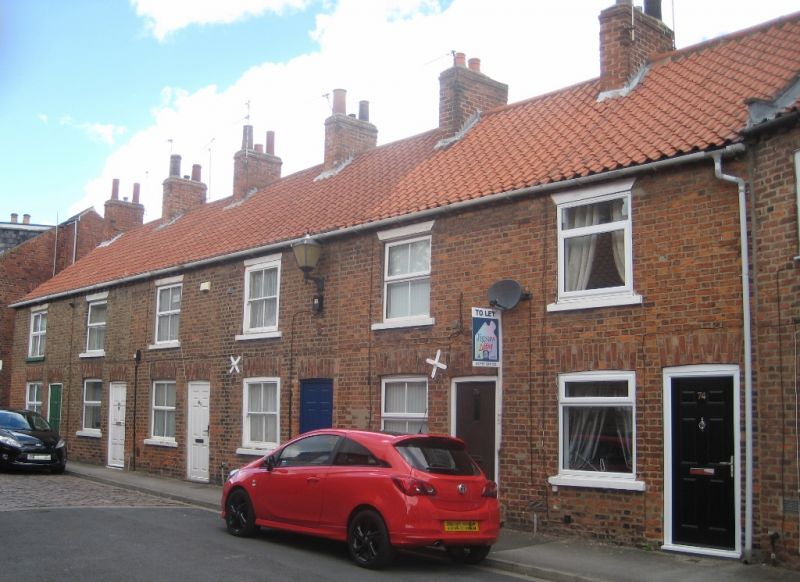
MILLGATE
1. (north-east side)
5342 -----------------
Nos 74 to 84 (even)
SE 6132 NW 1/107
II GV
2.
Early C19. Brown brick. Pantiled roof. Two storeys. Brick modillioned eaves
cornice. One bay each: cased flush-framed sashes. One door each with moulded
frames.
Listing NGR: SE6133732710
External links are from the relevant listing authority and, where applicable, Wikidata. Wikidata IDs may be related buildings as well as this specific building. If you want to add or update a link, you will need to do so by editing the Wikidata entry.


Other nearby listed buildings
