Approximate Location Map
Large Map »
Latitude: 53.7845 / 53°47'4"N
Longitude: -1.0654 / 1°3'55"W
OS Eastings: 461677
OS Northings: 432423
OS Grid: SE616324
Mapcode National: GBR PS0P.43
Mapcode Global: WHFD2.L4WK
Plus Code: 9C5WQWMM+QR
Entry Name: 19-25, New Street
Listing Date: 14 November 1980
Grade: II
Source: Historic England
Source ID: 1296864
English Heritage Legacy ID: 325812
ID on this website: 101296864
Location: Selby, North Yorkshire, YO8
County: North Yorkshire
District: Selby
Civil Parish: Selby
Built-Up Area: Selby
Traditional County: Yorkshire
Lieutenancy Area (Ceremonial County): North Yorkshire
Church of England Parish: Selby St Mary and St Germain
Church of England Diocese: York
Tagged with: Building
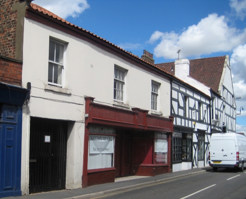
NEW STREET
1. (north-west side)
5342 -----------------
Nos 19 to 25 (odd)
SE 6132 SE 5/120
II GV
2.
Early C19. Stucco. Pitched pantile roof. Coped gable on cut kneeler. Two
storeys. Three sashes with glazing bars, three casements. Two late C19
shop-fronts.
Listing NGR: SE6167732423
External links are from the relevant listing authority and, where applicable, Wikidata. Wikidata IDs may be related buildings as well as this specific building. If you want to add or update a link, you will need to do so by editing the Wikidata entry.


Other nearby listed buildings
