Approximate Location Map
Large Map »
Latitude: 53.8963 / 53°53'46"N
Longitude: -0.9629 / 0°57'46"W
OS Eastings: 468245
OS Northings: 444954
OS Grid: SE682449
Mapcode National: GBR PRQD.B1
Mapcode Global: WHFCK.5BQD
Plus Code: 9C5XV2WP+GR
Entry Name: The Post Office
Listing Date: 23 August 1978
Grade: II
Source: Historic England
Source ID: 1296829
English Heritage Legacy ID: 326252
ID on this website: 101296829
Location: Wheldrake, York, North Yorkshire, YO19
County: York
Civil Parish: Wheldrake
Built-Up Area: Wheldrake
Traditional County: Yorkshire
Lieutenancy Area (Ceremonial County): North Yorkshire
Church of England Parish: Wheldrake St Helen
Church of England Diocese: York
Tagged with: Post office
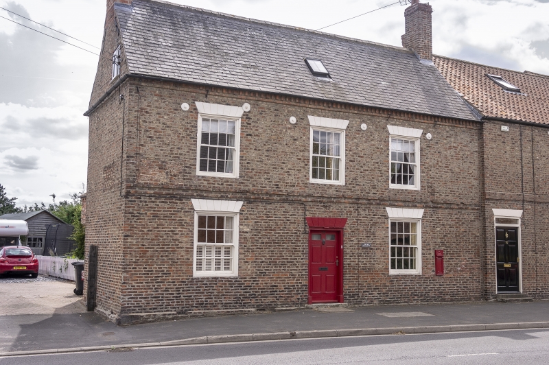
WHELDRAKE MAIN STREET
SE 6844-6944
(south side)
14/139 No 72 (The Post Office)
23.8.78
GV II
House, now house and shop. Late C18 with later additions and alterations.
Pinkish-brown brick with Welsh slate roof. 2 storeys, 3 bays. Central
entrance a 6-panel door. 16-pane sashes throughout. All openings under
wedge lintels. Stepped 3-course first-floor band. Dentil eaves band. End
stacks.
Listing NGR: SE6824244952
External links are from the relevant listing authority and, where applicable, Wikidata. Wikidata IDs may be related buildings as well as this specific building. If you want to add or update a link, you will need to do so by editing the Wikidata entry.


Other nearby listed buildings
