Approximate Location Map
Large Map »
Latitude: 53.7979 / 53°47'52"N
Longitude: -1.2522 / 1°15'8"W
OS Eastings: 449351
OS Northings: 433766
OS Grid: SE493337
Mapcode National: GBR MSPJ.P9
Mapcode Global: WHDBN.QSWV
Plus Code: 9C5WQPXX+44
Entry Name: The Village Centre
Listing Date: 16 May 1986
Grade: II
Source: Historic England
Source ID: 1316341
English Heritage Legacy ID: 326371
ID on this website: 101316341
Location: Sherburn in Elmet, North Yorkshire, LS25
County: North Yorkshire
District: Selby
Civil Parish: Sherburn in Elmet
Built-Up Area: Sherburn in Elmet
Traditional County: Yorkshire
Lieutenancy Area (Ceremonial County): North Yorkshire
Church of England Parish: Sherburn-in-Elmet All Saints
Church of England Diocese: York
Tagged with: Architectural structure
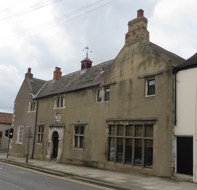
SHERBURN IN ELMET FINKLE HILL
SE 43 SE (west side)
The Village Centre
6/33
II
GV
Grammar School, now Village Hall. 1619 with later additions and
alterations. Founded under the will of Robert Hungate. Magnesian
limestone, now largely cement rendered, with Welsh slate roof. U-shaped on
plan with infill to rear. 2 storeys, 4 first-floor windows. Plinth,
quoins. Central round-arched entrance now a multi-paned window within wide
surround with moulded base, above a carved cartouche bearing the Hungate
arms. Entrance now to left return a C20 long-panel door under Tudor arch
and with chamfered jambs. Ground floor to front facade has 2 and 5-light
mullion and transom windows and an 18-pane sash all under hood-moulds.
First floor has mainly 2-light mullion windows and 1 single light, all under
hood-moulds. Returns are gabled with moulded ashlar coping. Ridge and end
stacks. In process of alteration and demolition to rear at time of
resurvey. Pevsner N, Yorkshire, The West Riding, 1979, p 482.
Listing NGR: SE4935133766
External links are from the relevant listing authority and, where applicable, Wikidata. Wikidata IDs may be related buildings as well as this specific building. If you want to add or update a link, you will need to do so by editing the Wikidata entry.


Other nearby listed buildings
