Approximate Location Map
Large Map »
Latitude: 53.6674 / 53°40'2"N
Longitude: -1.202 / 1°12'7"W
OS Eastings: 452823
OS Northings: 419288
OS Grid: SE528192
Mapcode National: GBR NV11.K2
Mapcode Global: WHDCG.H2VT
Plus Code: 9C5WMQ8X+X6
Entry Name: Village Cross
Listing Date: 11 December 1967
Grade: II
Source: Historic England
Source ID: 1316343
English Heritage Legacy ID: 326492
ID on this website: 101316343
Location: Womersley, North Yorkshire, DN6
County: North Yorkshire
District: Selby
Civil Parish: Womersley
Traditional County: Yorkshire
Lieutenancy Area (Ceremonial County): North Yorkshire
Church of England Parish: Womersley St Martin
Church of England Diocese: Leeds
Tagged with: High cross
SE 51 NW
5/17
11.12.67
WOMERSLEY
BANK WOOD ROAD
(north side)
Village Cross
GV
II
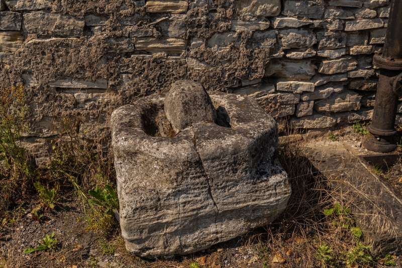
Village cross. Medieval. Magnesian limestone. Square plinth tapering to
octagonal base with stump of cross shaft remaining. The whole approximately
0.75 metres high.
Listing NGR: SE5282319288
External links are from the relevant listing authority and, where applicable, Wikidata. Wikidata IDs may be related buildings as well as this specific building. If you want to add or update a link, you will need to do so by editing the Wikidata entry.


Other nearby listed buildings
