Approximate Location Map
Large Map »
Latitude: 54.4891 / 54°29'20"N
Longitude: -0.6112 / 0°36'40"W
OS Eastings: 490059
OS Northings: 511308
OS Grid: NZ900113
Mapcode National: GBR SJ5J.GK
Mapcode Global: WHG9Y.LF4D
Plus Code: 9C6XF9QQ+MG
Entry Name: 4, Henrietta Street
Listing Date: 4 December 1972
Grade: II
Source: Historic England
Source ID: 1148222
English Heritage Legacy ID: 326834
ID on this website: 101148222
Location: Whitby, North Yorkshire, YO22
County: North Yorkshire
District: Scarborough
Civil Parish: Whitby
Built-Up Area: Whitby
Traditional County: Yorkshire
Lieutenancy Area (Ceremonial County): North Yorkshire
Church of England Parish: Whitby St Mary
Church of England Diocese: York
Tagged with: Building
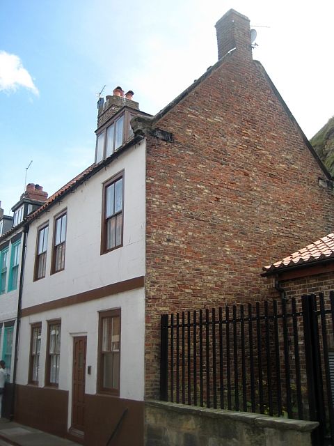
1.
1811 HENRIETTA STREET
(South Side)
No 4
NZ 9011 2/152
II GV
2.
Mid C18. 2 storeys. Rendered. Pantile roof. 3 windows, wood architraves,
sashes, no glazing bars. Modern door. Rendered band between storeys.
Listed as part or a group.
No 4 to 22 (even) form a group.
Listing NGR: NZ9005911308
External links are from the relevant listing authority and, where applicable, Wikidata. Wikidata IDs may be related buildings as well as this specific building. If you want to add or update a link, you will need to do so by editing the Wikidata entry.


Other nearby listed buildings
