Approximate Location Map
Large Map »
Latitude: 54.4714 / 54°28'16"N
Longitude: -0.6299 / 0°37'47"W
OS Eastings: 488891
OS Northings: 509310
OS Grid: NZ888093
Mapcode National: GBR SJ1Q.FX
Mapcode Global: WHG9Y.9W91
Plus Code: 9C6XF9CC+H3
Entry Name: 11 and 13, High Street
Listing Date: 4 December 1972
Grade: II
Source: Historic England
Source ID: 1205154
English Heritage Legacy ID: 326855
ID on this website: 101205154
Location: Ruswarp, North Yorkshire, YO21
County: North Yorkshire
District: Scarborough
Civil Parish: Whitby
Built-Up Area: Whitby
Traditional County: Yorkshire
Lieutenancy Area (Ceremonial County): North Yorkshire
Tagged with: Building
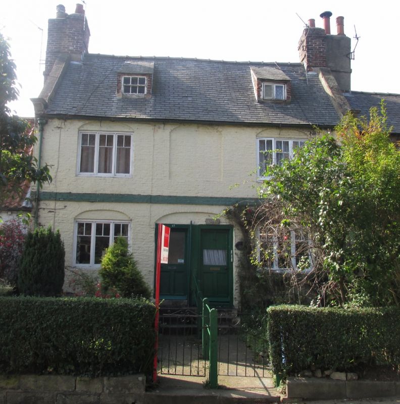
1.
1811 HIGH STREET
(West Side)
RUSWARP
Nos 11 & 13
NZ 8809 10/229 23.2.54.
II GV
2.
C18. 2 storeys in painted brick. Welsh slate roof. Sloped dormers. Bands
between storeys. 3 blank round-headed panels, the 2 outer containing 3-light
modern casements. Central modern doors in segmental arched reveal. Stone
capped gables.
Nos 1 to 33 (odd) form a group.
Listing NGR: NZ8889109310
External links are from the relevant listing authority and, where applicable, Wikidata. Wikidata IDs may be related buildings as well as this specific building. If you want to add or update a link, you will need to do so by editing the Wikidata entry.


Other nearby listed buildings
