Approximate Location Map
Large Map »
Latitude: 54.5208 / 54°31'14"N
Longitude: -0.7099 / 0°42'35"W
OS Eastings: 483605
OS Northings: 514710
OS Grid: NZ836147
Mapcode National: GBR RJH5.36
Mapcode Global: WHG9Q.2M7N
Plus Code: 9C6XG7CR+82
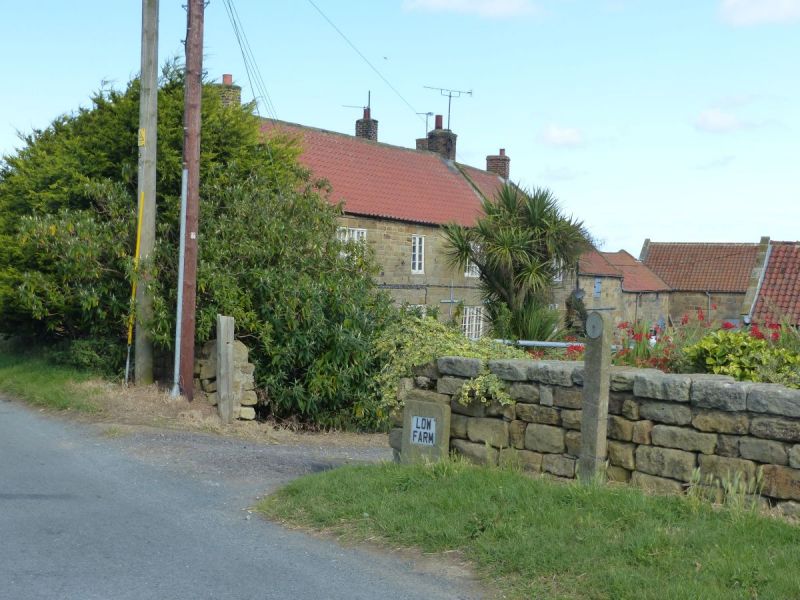
Entry Name: Low Farmhouse
Listing Date: 6 October 1969
Grade: II
Source: Historic England
Source ID: 1148900
English Heritage Legacy ID: 327261
ID on this website: 101148900
Location: Goldsborough, North Yorkshire, YO21
County: North Yorkshire
District: Scarborough
Civil Parish: Lythe
Traditional County: Yorkshire
Lieutenancy Area (Ceremonial County): North Yorkshire
Church of England Parish: Lythe with Sandsend
Church of England Diocese: York
Tagged with: Farmhouse
NZ 8314 LYTHE GOLDSBOROUGH LANE
(north side)
12/186
Low Farmhouse
6.10.69
GV II
Farmhouse of 2 builds, both C18. Coursed squared stone. Pantiled roofs with
stone copings and square kneelers, brick chimneys. Two storeys, one and two
bays. All windows C19 one-bar triple casements, those on ground floor with key-
stones. Six panel door, top glazed.
Listing NGR: NZ8360514710
External links are from the relevant listing authority and, where applicable, Wikidata. Wikidata IDs may be related buildings as well as this specific building. If you want to add or update a link, you will need to do so by editing the Wikidata entry.


Other nearby listed buildings
