Approximate Location Map
Large Map »
Latitude: 54.5056 / 54°30'20"N
Longitude: -0.6931 / 0°41'35"W
OS Eastings: 484722
OS Northings: 513039
OS Grid: NZ847130
Mapcode National: GBR RJLB.RN
Mapcode Global: WHG9X.B06R
Plus Code: 9C6XG844+6Q
Entry Name: Victoria House
Listing Date: 10 December 1985
Grade: II
Source: Historic England
Source ID: 1148868
English Heritage Legacy ID: 327287
ID on this website: 101148868
Location: Lythe, North Yorkshire, YO21
County: North Yorkshire
District: Scarborough
Civil Parish: Lythe
Traditional County: Yorkshire
Lieutenancy Area (Ceremonial County): North Yorkshire
Church of England Parish: Lythe with Sandsend
Church of England Diocese: York
Tagged with: House
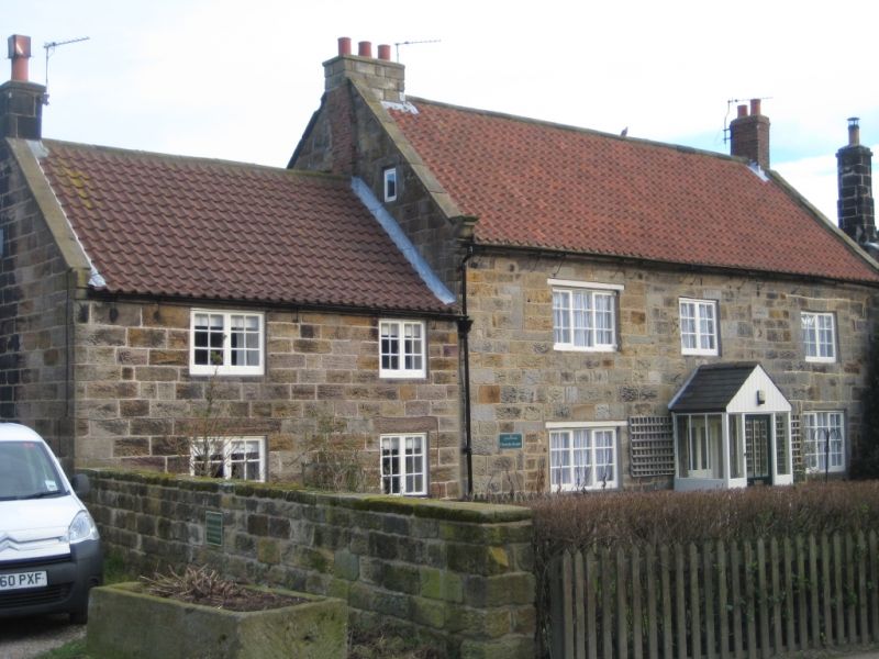
NZ 8413 LYTHE LODGE ROAD
(east side) Lythe
13/212
- Victoria House
- II
House, early C19. Coursed square stone. Pantiled roof with stone copings and
shaped kneelers. Two storeys, 3 bays and lower 2-storey, 2-bay north extension.
C20 small-paned casements. Small boarded door in gable end. Lower 2-storey
rear extension.
Listing NGR: NZ8472213039
External links are from the relevant listing authority and, where applicable, Wikidata. Wikidata IDs may be related buildings as well as this specific building. If you want to add or update a link, you will need to do so by editing the Wikidata entry.


Other nearby listed buildings
