Approximate Location Map
Large Map »
Latitude: 54.5054 / 54°30'19"N
Longitude: -0.693 / 0°41'34"W
OS Eastings: 484730
OS Northings: 513022
OS Grid: NZ847130
Mapcode National: GBR RJLB.RP
Mapcode Global: WHG9X.B07W
Plus Code: 9C6XG844+5R
Entry Name: The Old Vicarage
Listing Date: 10 December 1985
Grade: II
Source: Historic England
Source ID: 1301702
English Heritage Legacy ID: 327288
ID on this website: 101301702
Location: Lythe, North Yorkshire, YO21
County: North Yorkshire
District: Scarborough
Civil Parish: Lythe
Traditional County: Yorkshire
Lieutenancy Area (Ceremonial County): North Yorkshire
Church of England Parish: Lythe with Sandsend
Church of England Diocese: York
Tagged with: Clergy house
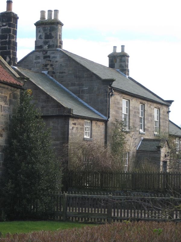
NZ 8413 LYTHE LODGE ROAD
(east side) Lythe
13/213
- The Old Vicarage
- II
House, C18. Coursed squared stone. Roof with stone copings and shaped large
kneelers. End stone corniced chimneys. Two storeys. 3-bay central section
and lower, 1-bay wings. Central gabled porch. Recessed sash windows with gla-
zing bars have projecting cills. Small rear extension.
Listing NGR: NZ8473013022
External links are from the relevant listing authority and, where applicable, Wikidata. Wikidata IDs may be related buildings as well as this specific building. If you want to add or update a link, you will need to do so by editing the Wikidata entry.


Other nearby listed buildings
