Approximate Location Map
Large Map »
Latitude: 54.3156 / 54°18'56"N
Longitude: -0.5179 / 0°31'4"W
OS Eastings: 496510
OS Northings: 492121
OS Grid: SE965921
Mapcode National: GBR SLTJ.NR
Mapcode Global: WHGBS.0SNH
Plus Code: 9C6X8F8J+6R
Entry Name: Water Tower
Listing Date: 14 April 1987
Grade: II
Source: Historic England
Source ID: 1172901
English Heritage Legacy ID: 327400
ID on this website: 101172901
Location: Silpho, North Yorkshire, YO13
County: North Yorkshire
District: Scarborough
Civil Parish: Silpho
Traditional County: Yorkshire
Lieutenancy Area (Ceremonial County): North Yorkshire
Church of England Parish: Hackness with Harwood Dale
Church of England Diocese: York
Tagged with: Water tower
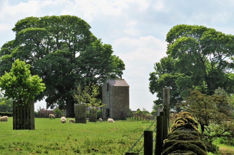
SE 99 SE SILPHO THE VILLAGE
(east side)
4/81 Water Tower
GV II
Water tower. Early-mid C19. Coursed rubble limestone on plinth, with
dressed quoins and slate roof. 2-stage tower approximately 10 metres high.
Harr-hung plank doors to both stages with roughly tooled lintels. Pitched
roof. In use until c1970.
Listing NGR: SE9651092121
External links are from the relevant listing authority and, where applicable, Wikidata. Wikidata IDs may be related buildings as well as this specific building. If you want to add or update a link, you will need to do so by editing the Wikidata entry.


Other nearby listed buildings
