Approximate Location Map
Large Map »
Latitude: 54.3928 / 54°23'33"N
Longitude: -0.7396 / 0°44'22"W
OS Eastings: 481935
OS Northings: 500431
OS Grid: NZ819004
Mapcode National: GBR RK8N.N2
Mapcode Global: WHF94.MV09
Plus Code: 9C6X97V6+45
Entry Name: Waymarker
Listing Date: 7 July 1989
Grade: II
Source: Historic England
Source ID: 1316177
English Heritage Legacy ID: 327586
ID on this website: 101316177
Location: North Yorkshire, YO22
County: North Yorkshire
District: Scarborough
Civil Parish: Goathland
Traditional County: Yorkshire
Lieutenancy Area (Ceremonial County): North Yorkshire
Church of England Parish: Goathland St Mary
Church of England Diocese: York
Tagged with: Milestone
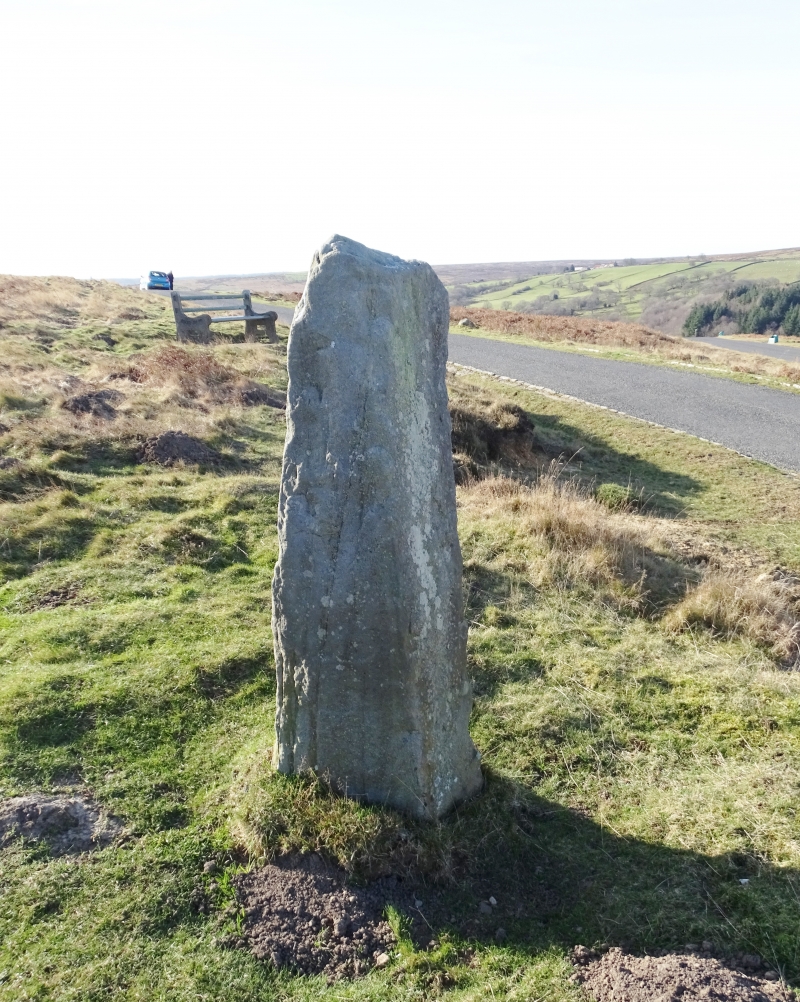
GOATHLAND HUNT HOUSE ROAD
NZ 80 SW 819004
(east side)
8/110 Waymarker
GV II
Waymarker. Probably C17 or early C18. Gritstone. Squared, tapering
monolith approximately 1.3 metres high. OSBM on west face.
Listing NGR: NZ8193500431
External links are from the relevant listing authority and, where applicable, Wikidata. Wikidata IDs may be related buildings as well as this specific building. If you want to add or update a link, you will need to do so by editing the Wikidata entry.


Other nearby listed buildings
