Approximate Location Map
Large Map »
Latitude: 54.4384 / 54°26'18"N
Longitude: -0.8999 / 0°53'59"W
OS Eastings: 471448
OS Northings: 505329
OS Grid: NZ714053
Mapcode National: GBR QK43.ZR
Mapcode Global: WHF8W.4PQV
Plus Code: 9C6XC4Q2+82
Entry Name: Farm Buildings to West of Stonebeck Gate Farmhouse
Listing Date: 6 October 1969
Last Amended: 20 December 1990
Grade: II
Source: Historic England
Source ID: 1148568
English Heritage Legacy ID: 327989
ID on this website: 101148568
Location: North Yorkshire, YO21
County: North Yorkshire
District: Scarborough
Civil Parish: Danby
Traditional County: Yorkshire
Lieutenancy Area (Ceremonial County): North Yorkshire
Church of England Parish: Danby with Castleton and Commondale
Church of England Diocese: York
Tagged with: Agricultural structure
NZ 70 NW DANBY STONEBECK GATE LANE
North side
7/70 Farm buildings to west
6/10/69 of Stonebeck Gate
Farmhouse (formerly
listed as part of out-
buildings SW of house)
GV II
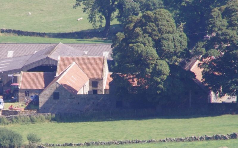
Planned farm layout, incorporating buildings for all farming
purposes in continuous ranges around a courtyard. 1832 dated and
named G. & A. Walker on keystone of arch on south face. Coursed
tooled sandstone, some (possibly re-used) with herringbone.
Pantiled roofs with stone copings and kneelers. All doors and most
openings boarded, under heavy lintels. Near-square plan with north-
east extension.
South front has large central rebated segmental entrance arch with
cut voussoirs and inscribed keystone with sunflower ornament. Left
cartshed has 2 rebated entrances with chamfered corners. Right 2
boarded doors to byre, with loft over. Inner face shows stone
stairs, with kennel under, to granary over cartshed.
West face, to road, is imposing and near-symmetrical. Square
central dovecot with pyramidal roof is flanked by 1-storey stables
and l½ storey gabled end sections. Blocked segmental carriage arch,
with cut voussoirs and lion mask on keystone, in dovecot. Inserted
pitching door over, and another in the left gable; 3 small openings
above 3 slit vents in right section. Internally there are 5 stable
doors and pigeon entrance high in the dovecot.
The north range has byres and loose boxes with lofts overs; 3 doors,
2 pitching doors above and a pattern of slit vents. At north-east
corner a barn of 2 full storeys, end on, with lower, projecting
horse-engine house. Internally are 3 stable doors in centre, 2
plain doors at ends, slit vents above and a blocked owl hole.
Block kneelers and slightly-swept roof.
The east range has 1-storey pigsties to west of barn; barn has 2
doors and 2 alternately-set loading doors over. Pigsty wall is
blank but inner face shows 3 boarded doors and segment-arched
feeding chutes. Loose-box in corner of barn to left.
A well-preserved example of an earlier C19 planned farm.
Listing NGR: NZ7144805329
External links are from the relevant listing authority and, where applicable, Wikidata. Wikidata IDs may be related buildings as well as this specific building. If you want to add or update a link, you will need to do so by editing the Wikidata entry.


Other nearby listed buildings
