Approximate Location Map
Large Map »
Latitude: 54.4669 / 54°28'0"N
Longitude: -0.8665 / 0°51'59"W
OS Eastings: 473563
OS Northings: 508538
OS Grid: NZ735085
Mapcode National: GBR QJDS.6J
Mapcode Global: WHF8P.NZLH
Plus Code: 9C6XF48M+Q9
Entry Name: Boundary Stone to North of Oakley Walls Farmhouse
Listing Date: 20 December 1990
Grade: II
Source: Historic England
Source ID: 1148589
English Heritage Legacy ID: 328037
ID on this website: 101148589
Location: Houlsyke, North Yorkshire, YO21
County: North Yorkshire
District: Scarborough
Civil Parish: Glaisdale
Traditional County: Yorkshire
Lieutenancy Area (Ceremonial County): North Yorkshire
Church of England Parish: Glaisdale St Thomas
Church of England Diocese: York
Tagged with: Boundary marker
NZ 70 NW GLAISDALE OAKLEY WALLS
736 086
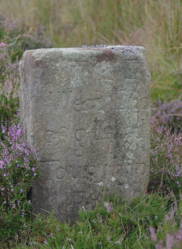
7/118 Boundary stone
to north of
Oakley Walls
Farmhouse
II
Boundary stone dated 1736. Gritstone. About 0.4 m. above ground;
inscribed on East face: THE West End of Glaisld (sic) Township 1736.
Herringbone tooling on west face.
Listing NGR: NZ7356308538
External links are from the relevant listing authority and, where applicable, Wikidata. Wikidata IDs may be related buildings as well as this specific building. If you want to add or update a link, you will need to do so by editing the Wikidata entry.


Other nearby listed buildings
