Approximate Location Map
Large Map »
Latitude: 54.2465 / 54°14'47"N
Longitude: -0.7796 / 0°46'46"W
OS Eastings: 479622
OS Northings: 484116
OS Grid: SE796841
Mapcode National: GBR RM0B.0H
Mapcode Global: WHF9X.0J1C
Plus Code: 9C6X66WC+J5
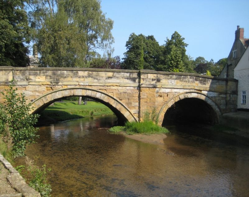
Entry Name: Pickering Bridge
Listing Date: 24 October 1950
Grade: II
Source: Historic England
Source ID: 1172952
English Heritage Legacy ID: 328152
ID on this website: 101172952
Location: Pickering, North Yorkshire, YO18
County: North Yorkshire
District: Ryedale
Civil Parish: Pickering
Built-Up Area: Pickering
Traditional County: Yorkshire
Lieutenancy Area (Ceremonial County): North Yorkshire
Church of England Parish: Pickering St Peter and St Paul
Church of England Diocese: York
Tagged with: Bridge
BRIDGE STREET
1.
5340
Pickering Bridge
SE 7984 1/48 24.lO.50.
II GV
2.
4 arches, centre segmental with small flood arches on both sides with pilasters
between. 1 arch mediaeval and ribbed, the rest C18. Stone.
Forms a group with properties in Bridge Street and Beck Isle.
Listing NGR: SE7962584116
External links are from the relevant listing authority and, where applicable, Wikidata. Wikidata IDs may be related buildings as well as this specific building. If you want to add or update a link, you will need to do so by editing the Wikidata entry.


Other nearby listed buildings
