Approximate Location Map
Large Map »
Latitude: 54.2989 / 54°17'55"N
Longitude: -1.1523 / 1°9'8"W
OS Eastings: 455264
OS Northings: 489583
OS Grid: SE552895
Mapcode National: GBR NLDQ.BQ
Mapcode Global: WHD8D.86JR
Plus Code: 9C6W7RXX+H3
Entry Name: Easterside Farmhouse
Listing Date: 14 March 1986
Grade: II
Source: Historic England
Source ID: 1191126
English Heritage Legacy ID: 328482
ID on this website: 101191126
Location: North Yorkshire, YO62
County: North Yorkshire
District: Ryedale
Civil Parish: Hawnby
Traditional County: Yorkshire
Lieutenancy Area (Ceremonial County): North Yorkshire
Church of England Parish: Upper Ryedale
Church of England Diocese: York
Tagged with: Farmhouse
SE 58 NE BILSDALE WEST SIDE EASTERSIDE LANE
(south side)
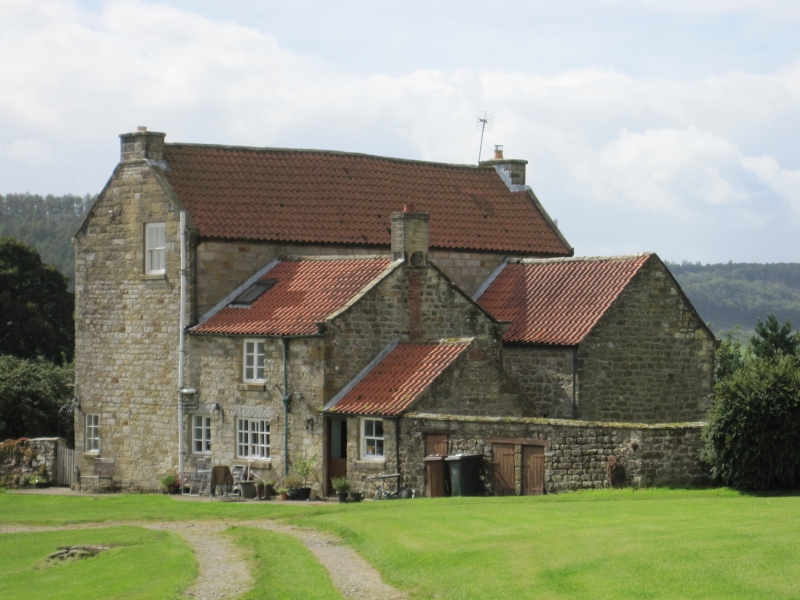
7/7 Easterside Farmhouse
- II
House. Late C18. Sandstone ashlar, pantile roof. Central entry with
2 cross wings to rear. 2 storeys, 3 first floor windows. Herringbone
tooling. Half-glazed door beneath divided overlight. Casements beneath
stone lintels throughout. Stepped eaves course. Swept roof, gable coping,
shaped kneelers, end stacks.
Listing NGR: SE5526489583
External links are from the relevant listing authority and, where applicable, Wikidata. Wikidata IDs may be related buildings as well as this specific building. If you want to add or update a link, you will need to do so by editing the Wikidata entry.


Other nearby listed buildings
