Approximate Location Map
Large Map »
Latitude: 54.2283 / 54°13'41"N
Longitude: -1.1441 / 1°8'38"W
OS Eastings: 455892
OS Northings: 481732
OS Grid: SE558817
Mapcode National: GBR NMGK.31
Mapcode Global: WHD8L.DZDF
Plus Code: 9C6W6VH4+88
Entry Name: Milepost Approximately 30 Metres South of High Lodge
Listing Date: 14 March 1986
Grade: II
Source: Historic England
Source ID: 1191336
English Heritage Legacy ID: 328524
ID on this website: 101191336
Location: North Yorkshire, YO7
County: North Yorkshire
District: Ryedale
Civil Parish: Old Byland and Scawton
Traditional County: Yorkshire
Lieutenancy Area (Ceremonial County): North Yorkshire
Church of England Parish: Upper Ryedale
Church of England Diocese: York
Tagged with: Milestone
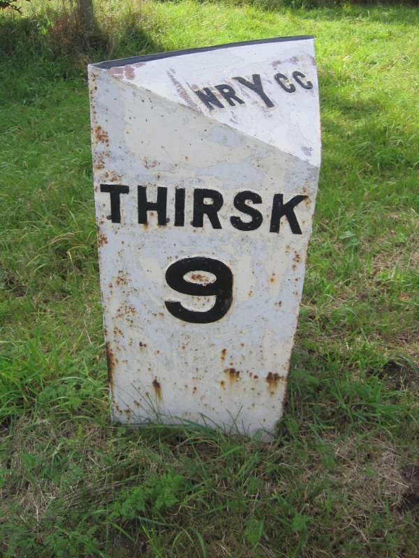
SE 58 SE SCAWTON A 170
(south side)
9/48 Milepost approximately 30
metres south of High
Lodge
- II
Milepost. Late C19. Cast iron. Triangular on plan. Left face: Thirsk 9.
Right face: Helmsley 5. Sloping upper face: NRYCC.
Listing NGR: SE5589281732
External links are from the relevant listing authority and, where applicable, Wikidata. Wikidata IDs may be related buildings as well as this specific building. If you want to add or update a link, you will need to do so by editing the Wikidata entry.


