Approximate Location Map
Large Map »
Latitude: 53.959 / 53°57'32"N
Longitude: -1.0337 / 1°2'1"W
OS Eastings: 463502
OS Northings: 451867
OS Grid: SE635518
Mapcode National: GBR PQ7N.0K
Mapcode Global: WHFC4.3R1B
Plus Code: 9C5WXX58+JG
Entry Name: Church of St Thomas
Listing Date: 29 January 1953
Grade: II
Source: Historic England
Source ID: 1173752
English Heritage Legacy ID: 328682
ID on this website: 101173752
Location: St Thomas's Church, Osbaldwick, York, North Yorkshire, YO19
County: York
Civil Parish: Osbaldwick
Built-Up Area: York
Traditional County: Yorkshire
Lieutenancy Area (Ceremonial County): North Yorkshire
Church of England Parish: Osbaldwick St Thomas
Church of England Diocese: York
Tagged with: Church building
NORTH YORKSHIRE
RYEDALE
5340
SE 65 SW OSBALDWICK MURTON WAY
(south side)
4/26
Church of St Thomas
29.1.53
GV II
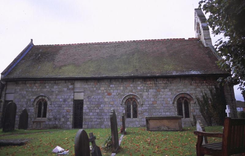
Church. C12 in origin with extensive restoration of 1877 by J Oldrid Scott
and alterations and additions of 1967 by A Mennim. Hammer-dressed
limestone, plain tile roof. Medieval 4-bay nave and chancel, south transept
with vestry and porch to south and organ chamber to south-east of 1967.
West front: 2-light plate-traceried window beneath round arch with hood-
mould and label stops, with oculus and bellcote above. C20 porch to right.
Nave: north side has 3 windows as west front, the central one being a
restoration, and 2 full-length C20 windows. The south side of the nave is
obscured by the flat-roofed vestry. The 3-light Perpendicular window in the
south wall of the south transept is relocated from the east front which is
now blind. Interior: substantially remodelled on L-shaped plan in 1967.
Jacobean pulpit and communion rail. East side of south transept has
relocated round-arched doorway. Monument in south wall to Mary Ward: "To
love the poore, persever in the same, live, dy and rise with them was all
the ayme of Mary Ward who having lived 60 years and 8 days dyed the 20th of
Jan 1641."
Listing NGR: SE6350251867
External links are from the relevant listing authority and, where applicable, Wikidata. Wikidata IDs may be related buildings as well as this specific building. If you want to add or update a link, you will need to do so by editing the Wikidata entry.


Other nearby listed buildings
