Approximate Location Map
Large Map »
Latitude: 54.3052 / 54°18'18"N
Longitude: -0.8802 / 0°52'48"W
OS Eastings: 472964
OS Northings: 490538
OS Grid: SE729905
Mapcode National: GBR QL9N.7G
Mapcode Global: WHF9N.G13V
Plus Code: 9C6X8449+3W
Entry Name: St Chads Well
Listing Date: 24 June 1987
Grade: II
Source: Historic England
Source ID: 1149027
English Heritage Legacy ID: 328939
ID on this website: 101149027
Location: Lastingham, North Yorkshire, YO62
County: North Yorkshire
District: Ryedale
Civil Parish: Lastingham
Traditional County: Yorkshire
Lieutenancy Area (Ceremonial County): North Yorkshire
Church of England Parish: Lastingham St Mary
Church of England Diocese: York
Tagged with: Well
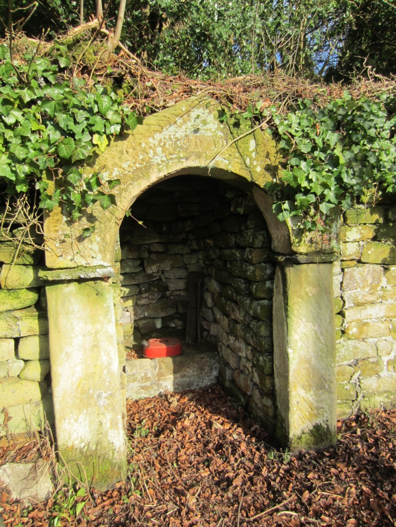
LASTINGHAM HIGH STREET
SE 7290
(east side)
12/102 St Chad's Well
- II
Public fountain. Probably C18 with early origins. Tooled sandstone and
coursed rubble sandstone. Rectangular recess set into wall, with
semicircular arch beneath shallow gabled lintel on plain jambs with imposts.
Shallow recessed panel to centre of lintel, inscribed " St CHAD". Interior:
iron pump and stone trough.
Listing NGR: SE7294090517
External links are from the relevant listing authority and, where applicable, Wikidata. Wikidata IDs may be related buildings as well as this specific building. If you want to add or update a link, you will need to do so by editing the Wikidata entry.


Other nearby listed buildings
