Approximate Location Map
Large Map »
Latitude: 54.3001 / 54°18'0"N
Longitude: -0.9172 / 0°55'1"W
OS Eastings: 470564
OS Northings: 489933
OS Grid: SE705899
Mapcode National: GBR QL1Q.78
Mapcode Global: WHF9M.W5FS
Plus Code: 9C6X832M+34
Entry Name: K6 Telephone Kiosk
Listing Date: 21 September 1989
Grade: II
Source: Historic England
Source ID: 1260759
English Heritage Legacy ID: 328953
ID on this website: 101260759
Location: Hutton-le-Hole, North Yorkshire, YO62
County: North Yorkshire
District: Ryedale
Civil Parish: Hutton-le-Hole
Traditional County: Yorkshire
Lieutenancy Area (Ceremonial County): North Yorkshire
Church of England Parish: Lastingham St Mary
Church of England Diocese: York
Tagged with: K6 telephone box
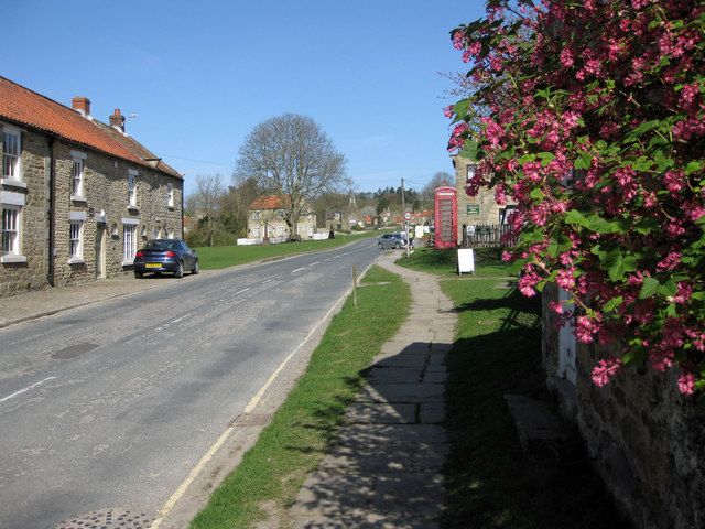
THE VILLAGE
SE 7090 - 7089
11/83A (east side)
K6 Telephone Kiosk
GV II
Telephone kiosk, type K6. Designed 1935 by Sir Giles Gilbert Scott. Made by
various contractors. Cast iron. Square kiosk with domed roof. Unperforated
crowns to top panels and margin glazing to windows and door.
Listing NGR: SE7056489933
External links are from the relevant listing authority and, where applicable, Wikidata. Wikidata IDs may be related buildings as well as this specific building. If you want to add or update a link, you will need to do so by editing the Wikidata entry.


Other nearby listed buildings
